Kasama geodata
Kasama (Northern) is a seat of a first-order administrative division; located in Zambia in Africa/Lusaka (GMT+2) time zone. With population of 91,056 people, there are 8 cities with bigger population in this country. Compared to other cities in Zambia, 86.4% of cities are located further ↓South; 83.3% of cities are located further ←West and 90.9% of cities have lower elevation than Kasama. Note1


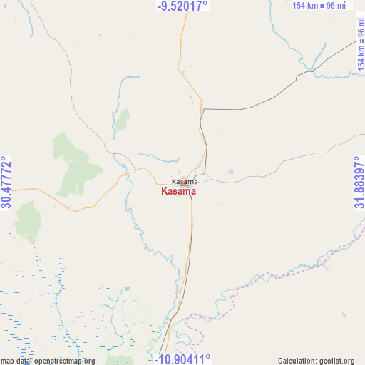
Kasama GPS coordinates[2]
10° 12' 46.404" South, 31° 10' 51.024" East
| Map corner | latitude | longitude |
|---|---|---|
| Upper-left | -9.52017°, | 30.47772° |
| Center: | -10.21289°, | 31.18084° |
| Lower-right: | -10.90411°, | 31.88397° |
| Map W x H: | 153.9×153.9 km | = 95.6×95.6mi |
| max Lat: | -8.46887° ⇑13.6% North |
| Kasama: | -10.21289° |
| min Lat: | ⇓86.4% South -17.84194° |
| min Long | Kasama | max Long |
| 22.67926° | 31.18084° | 33.1782° |
| W 83.3%⇐ | ⇒16.7% E |
Elevation
Elevation of Kasama is 1394 m = 4573 ft, and this is 250.6 m = 822 ft above average elevation for this country.
| Max E: |
1622 m = 5322 ft | 9.1% |
| Kasama | 1394 m 4573 ft | |
| Avg. | 1143.4 m = 3751 ft | |
Min E: |
328 m = 1076 ft | 90.9% |
See also: Kasama elevation on elevation.city.
Geographical zone
Kasama is located in South Torrid zone (between Equator and Tropic of Capricorn). Distance of Equator is 1135.6 km =705.6 mi to North.| Distance of | km | miles | from Kasama |
|---|---|---|---|
| Equator | 1135.6 | 705.6 | to North |
| Tropic Capricorn | 1470.4 | 913.7 | to South |
| Antarctic Circle | 6265.6 | 3893.3 | to South |
| South Pole | 8871.5 | 5512.5 | to South |


Nearby cities:
15 places around Kasama: (largest is in red/bold)
• Chama
242.4 km =150.6 mi,  117°
117°
• Chinsali
105.1 km =65.3 mi,  110°
110°
• Isoka
159.1 km =98.9 mi,  87°
87°
• Kaputa
255.7 km =158.9 mi,  319°
319°
• Kataba
240.3 km =149.3 mi,  219°
219°
• Kawambwa
234.9 km =146 mi,  281°
281°
• Luwingu
137.3 km =85.3 mi,  267°
267°
• Mbala
154 km =95.7 mi,  7°
7°
• Mpika
182.7 km =113.5 mi,  170°
170°
• Mporokoso
148.7 km =92.4 mi,  308°
308°
• Mpulungu
161.5 km =100.4 mi,  357°
357°
• Mungwi
21.1 km =13.1 mi,  77°
77°
• Mwense
272.3 km =169.2 mi, 265°
• Nakonde
196.8 km =122.3 mi,  60°
60°
• Samfya
218.8 km =136 mi,  234°
234°
Sources, notices
• [Note1] Compared only with cities in Zambia existing in our database
• [Src1] Map data: © OpenStreetMap contributors (CC-BY-SA)
• [Src2] Other city data from geonames.org with taken over terms of usage.
• [Src3] Geographical zone / Annual Mean Temperature by Robert A. Rohde @ Wikipedia
