Mwense geodata
Mwense (Luapula) is a populated place; located in Zambia in Africa/Lusaka (GMT+2) time zone. With population of 4,378 people, there are 58 cities with bigger population in this country. Compared to other cities in Zambia, 83.3% of cities are located further ↓South; 60.6% of cities are located further ←West and 84.8% of cities have higher elevation than Mwense. Note1


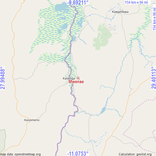
Mwense GPS coordinates[2]
10° 23' 4.092" South, 28° 41' 52.8" East
| Map corner | latitude | longitude |
|---|---|---|
| Upper-left | -9.69211°, | 27.99488° |
| Center: | -10.38447°, | 28.698° |
| Lower-right: | -11.0753°, | 29.40113° |
| Map W x H: | 153.8×153.8 km | = 95.6×95.6mi |
| max Lat: | -8.46887° ⇑16.7% North |
| Mwense: | -10.38447° |
| min Lat: | ⇓83.3% South -17.84194° |
| min Long | Mwense | max Long |
| 22.67926° | 28.698° | 33.1782° |
| W 60.6%⇐ | ⇒39.4% E |
Elevation
Elevation of Mwense is 959 m = 3146 ft, and this is 184.4 m = 605 ft below average elevation for this country.
| Max E: |
1622 m = 5322 ft | 84.8% |
| Avg. | 1143.4 m = 3751 ft | |
| Mwense | 959 m = 3146 ft | |
Min E: |
328 m = 1076 ft | 15.2% |
See also: Zambia elevation on elevation.city.
Geographical zone
Mwense is located in South Torrid zone (between Equator and Tropic of Capricorn). Distance of Equator is 1154.6 km =717.4 mi to North.| Distance of | km | miles | from Mwense |
|---|---|---|---|
| Equator | 1154.6 | 717.4 | to North |
| Tropic Capricorn | 1451.3 | 901.8 | to South |
| Antarctic Circle | 6246.5 | 3881.4 | to South |
| South Pole | 8852.4 | 5500.6 | to South |


Nearby cities:
15 places around Mwense: (largest is in red/bold)
• Chambishi
259.6 km =161.3 mi,  195°
195°
• Chililabombwe
240 km =149.1 mi, 203°
• Chingola
254.4 km =158.1 mi, 200°
• Kalulushi
281 km =174.6 mi,  193°
193°
• Kaputa
237.8 km =147.8 mi,  26°
26°
• Kasama
272.3 km =169.2 mi,  85°
85°
• Kataba
204.4 km =127 mi,  144°
144°
• Kawambwa
78 km =48.5 mi, 32°
• Kitwe
274 km =170.3 mi, 191°
• Luwingu
135.1 km =83.9 mi,  84°
84°
• Mansa
93.2 km =57.9 mi,  166°
166°
• Mporokoso
192.6 km =119.7 mi,  54°
54°
• Mufulira
245.9 km =152.8 mi, 191°
• Nchelenge
115.6 km =71.8 mi,  1°
1°
• Samfya
143.8 km =89.4 mi, 139°
Sources, notices
• [Note1] Compared only with cities in Zambia existing in our database
• [Src1] Map data: © OpenStreetMap contributors (CC-BY-SA)
• [Src2] Other city data from geonames.org with taken over terms of usage.
• [Src3] Geographical zone / Annual Mean Temperature by Robert A. Rohde @ Wikipedia
