Zambezi geodata
Zambezi (North-Western) is a populated place; located in Zambia in Africa/Lusaka (GMT+2) time zone. With population of 7,074 people, there are 48 cities with bigger population in this country. Compared to other cities in Zambia, 51.5% of cities are located further ↑North; 98.5% of cities are located further →East and 65.2% of cities have higher elevation than Zambezi. Note1


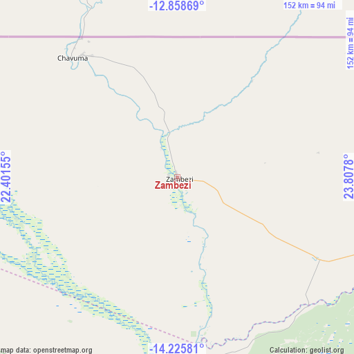
Zambezi GPS coordinates[2]
13° 32' 35.628" South, 23° 6' 16.812" East
| Map corner | latitude | longitude |
|---|---|---|
| Upper-left | -12.85869°, | 22.40155° |
| Center: | -13.54323°, | 23.10467° |
| Lower-right: | -14.22581°, | 23.8078° |
| Map W x H: | 152×152 km | = 94.4×94.4mi |
| max Lat: | -8.46887° ⇑51.5% North |
| Zambezi: | -13.54323° |
| min Lat: | ⇓48.5% South -17.84194° |
| min Long | Zambezi | max Long |
| 22.67926° | 23.10467° | 33.1782° |
| W 1.5%⇐ | ⇒98.5% E |
Elevation
Elevation of Zambezi is 1079 m = 3540 ft, and this is 64.4 m = 211 ft below average elevation for this country.
| Max E: |
1622 m = 5322 ft | 65.2% |
| Avg. | 1143.4 m = 3751 ft | |
| Zambezi | 1079 m = 3540 ft | |
Min E: |
328 m = 1076 ft | 34.8% |
See also: Zambia elevation on elevation.city.
Geographical zone
Zambezi is located in South Torrid zone (between Equator and Tropic of Capricorn). Distance of this Southern Tropic circle is 1100.1 km =683.6 mi to South.| Distance of | km | miles | from Zambezi |
|---|---|---|---|
| Equator | 1505.9 | 935.7 | to North |
| Tropic Capricorn | 1100.1 | 683.6 | to South |
| Antarctic Circle | 5895.3 | 3663.2 | to South |
| South Pole | 8501.2 | 5282.4 | to South |


Nearby cities:
14 places around Zambezi: (largest is in red/bold)
• Kabompo
118.6 km =73.7 mi,  92°
92°
• Kalabo
167.6 km =104.1 mi,  195°
195°
• Kalengwa
205.4 km =127.6 mi, 87°
• Kansanshi
394.6 km =245.2 mi,  65°
65°
• Kaoma
228.9 km =142.2 mi,  127°
127°
• Kasempa
295.2 km =183.4 mi, 88°
• Limulunga
172.8 km =107.4 mi,  178°
178°
• Lukulu
93.2 km =57.9 mi,  170°
170°
• Mongu
189.6 km =117.8 mi, 179°
• Mufumbwe
183.9 km =114.3 mi, 94°
• Mwinilunga
247.1 km =153.5 mi,  35°
35°
• Namwala
434.5 km =270 mi,  124°
124°
• Senanga
286.7 km =178.1 mi, 176°
• Solwezi
387.5 km =240.8 mi, 66°
Sources, notices
• [Note1] Compared only with cities in Zambia existing in our database
• [Src1] Map data: © OpenStreetMap contributors (CC-BY-SA)
• [Src2] Other city data from geonames.org with taken over terms of usage.
• [Src3] Geographical zone / Annual Mean Temperature by Robert A. Rohde @ Wikipedia
