Mufumbwe geodata
Mufumbwe (North-Western) is a populated place; located in Zambia in Africa/Lusaka (GMT+2) time zone. With population of 6,155 people, there are 52 cities with bigger population in this country. Compared to other cities in Zambia, 57.6% of cities are located further ↑North; 86.4% of cities are located further →East and 57.6% of cities have higher elevation than Mufumbwe. Note1


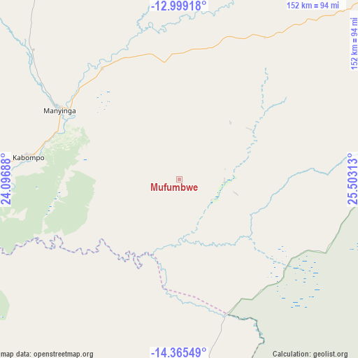
Mufumbwe GPS coordinates[2]
13° 40' 59.988" South, 24° 48' 0" East
| Map corner | latitude | longitude |
|---|---|---|
| Upper-left | -12.99918°, | 24.09688° |
| Center: | -13.68333°, | 24.8° |
| Lower-right: | -14.36549°, | 25.50313° |
| Map W x H: | 151.9×151.9 km | = 94.4×94.4mi |
| max Lat: | -8.46887° ⇑57.6% North |
| Mufumbwe: | -13.68333° |
| min Lat: | ⇓42.4% South -17.84194° |
| min Long | Mufumbwe | max Long |
| 22.67926° | 24.8° | 33.1782° |
| W 13.6%⇐ | ⇒86.4% E |
Elevation
Elevation of Mufumbwe is 1143 m = 3750 ft, and this is 0.40000000000009 m = 1 ft below average elevation for this country.
| Max E: |
1622 m = 5322 ft | 57.6% |
| Avg. | 1143.4 m = 3751 ft | |
| Mufumbwe | 1143 m = 3750 ft | |
Min E: |
328 m = 1076 ft | 42.4% |
See also: Zambia elevation on elevation.city.
Geographical zone
Mufumbwe is located in South Torrid zone (between Equator and Tropic of Capricorn). Distance of this Southern Tropic circle is 1084.5 km =673.9 mi to South.| Distance of | km | miles | from Mufumbwe |
|---|---|---|---|
| Equator | 1521.4 | 945.4 | to North |
| Tropic Capricorn | 1084.5 | 673.9 | to South |
| Antarctic Circle | 5879.7 | 3653.5 | to South |
| South Pole | 8485.6 | 5272.7 | to South |


Nearby cities:
15 places around Mufumbwe: (largest is in red/bold)
• Kabompo
65.5 km =40.7 mi,  278°
278°
• Kalabo
270.9 km =168.3 mi,  237°
237°
• Kalengwa
32.6 km =20.3 mi,  42°
42°
• Kansanshi
249.6 km =155.1 mi, 44°
• Kaoma
122.3 km =76 mi,  180°
180°
• Kasempa
114.5 km =71.1 mi,  77°
77°
• Limulunga
238.2 km =148 mi,  228°
228°
• Lukulu
184.6 km =114.7 mi,  245°
245°
• Mongu
250.4 km =155.6 mi, 225°
• Mumbwa
283.3 km =176 mi,  120°
120°
• Mwinilunga
220.2 km =136.8 mi,  349°
349°
• Namwala
289.6 km =179.9 mi,  142°
142°
• Senanga
316.8 km =196.9 mi,  211°
211°
• Solwezi
240.9 km =149.7 mi,  45°
45°
• Zambezi
183.9 km =114.3 mi,  274°
274°
Sources, notices
• [Note1] Compared only with cities in Zambia existing in our database
• [Src1] Map data: © OpenStreetMap contributors (CC-BY-SA)
• [Src2] Other city data from geonames.org with taken over terms of usage.
• [Src3] Geographical zone / Annual Mean Temperature by Robert A. Rohde @ Wikipedia
