Kaoma geodata
Kaoma (Western) is a populated place; located in Zambia in Africa/Lusaka (GMT+2) time zone. With population of 14,212 people, there are 29 cities with bigger population in this country. Compared to other cities in Zambia, 69.7% of cities are located further ↑North; 86.4% of cities are located further →East and 59.1% of cities have higher elevation than Kaoma. Note1


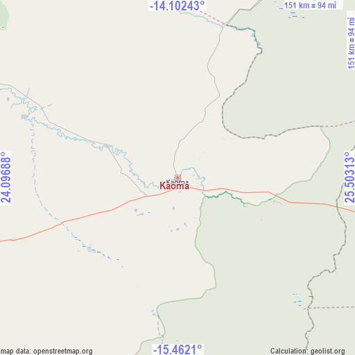
Kaoma GPS coordinates[2]
14° 46' 59.988" South, 24° 48' 0" East
| Map corner | latitude | longitude |
|---|---|---|
| Upper-left | -14.10243°, | 24.09688° |
| Center: | -14.78333°, | 24.8° |
| Lower-right: | -15.4621°, | 25.50313° |
| Map W x H: | 151.2×151.2 km | = 94×94mi |
| max Lat: | -8.46887° ⇑69.7% North |
| Kaoma: | -14.78333° |
| min Lat: | ⇓30.3% South -17.84194° |
| min Long | Kaoma | max Long |
| 22.67926° | 24.8° | 33.1782° |
| W 13.6%⇐ | ⇒86.4% E |
Elevation
Elevation of Kaoma is 1126 m = 3694 ft, and this is 17.4 m = 57 ft below average elevation for this country.
| Max E: |
1622 m = 5322 ft | 59.1% |
| Avg. | 1143.4 m = 3751 ft | |
| Kaoma | 1126 m = 3694 ft | |
Min E: |
328 m = 1076 ft | 40.9% |
See also: Zambia elevation on elevation.city.
Geographical zone
Kaoma is located in South Torrid zone (between Equator and Tropic of Capricorn). Distance of this Southern Tropic circle is 962.2 km =597.9 mi to South.| Distance of | km | miles | from Kaoma |
|---|---|---|---|
| Equator | 1643.8 | 1021.4 | to North |
| Tropic Capricorn | 962.2 | 597.9 | to South |
| Antarctic Circle | 5757.4 | 3577.5 | to South |
| South Pole | 8363.3 | 5196.7 | to South |


Nearby cities:
15 places around Kaoma: (largest is in red/bold)
• Choma
324.8 km =201.8 mi,  133°
133°
• Kabompo
147.3 km =91.5 mi,  333°
333°
• Kalabo
229.1 km =142.4 mi,  264°
264°
• Kalengwa
148.1 km =92 mi,  8°
8°
• Kasempa
184.7 km =114.8 mi,  37°
37°
• Limulunga
182 km =113.1 mi, 258°
• Lukulu
173.8 km =108 mi,  285°
285°
• Mongu
186.9 km =116.1 mi,  253°
253°
• Monze
332.3 km =206.5 mi,  120°
120°
• Mufumbwe
122.3 km =76 mi,  0°
0°
• Mumbwa
244.1 km =151.7 mi,  95°
95°
• Namwala
206 km =128 mi, 121°
• Senanga
221.3 km =137.5 mi,  227°
227°
• Sesheke
304.2 km =189 mi,  190°
190°
• Zambezi
228.9 km =142.2 mi,  307°
307°
Sources, notices
• [Note1] Compared only with cities in Zambia existing in our database
• [Src1] Map data: © OpenStreetMap contributors (CC-BY-SA)
• [Src2] Other city data from geonames.org with taken over terms of usage.
• [Src3] Geographical zone / Annual Mean Temperature by Robert A. Rohde @ Wikipedia
