Namwala geodata
Namwala (Southern) is a populated place; located in Zambia in Africa/Lusaka (GMT+2) time zone. With population of 4,450 people, there are 57 cities with bigger population in this country. Compared to other cities in Zambia, 81.8% of cities are located further ↑North; 75.8% of cities are located further →East and 80.3% of cities have higher elevation than Namwala. Note1


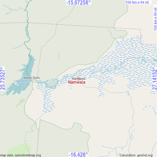
Namwala GPS coordinates[2]
15° 45' 1.512" South, 26° 26' 18.204" East
| Map corner | latitude | longitude |
|---|---|---|
| Upper-left | -15.07258°, | 25.73527° |
| Center: | -15.75042°, | 26.43839° |
| Lower-right: | -16.426°, | 27.14152° |
| Map W x H: | 150.5×150.5 km | = 93.5×93.5mi |
| max Lat: | -8.46887° ⇑81.8% North |
| Namwala: | -15.75042° |
| min Lat: | ⇓18.2% South -17.84194° |
| min Long | Namwala | max Long |
| 22.67926° | 26.43839° | 33.1782° |
| W 24.2%⇐ | ⇒75.8% E |
Elevation
Elevation of Namwala is 999 m = 3278 ft, and this is 144.4 m = 474 ft below average elevation for this country.
| Max E: |
1622 m = 5322 ft | 80.3% |
| Avg. | 1143.4 m = 3751 ft | |
| Namwala | 999 m = 3278 ft | |
Min E: |
328 m = 1076 ft | 19.7% |
See also: Zambia elevation on elevation.city.
Geographical zone
Namwala is located in South Torrid zone (between Equator and Tropic of Capricorn). Distance of this Southern Tropic circle is 854.6 km =531 mi to South.| Distance of | km | miles | from Namwala |
|---|---|---|---|
| Equator | 1751.3 | 1088.2 | to North |
| Tropic Capricorn | 854.6 | 531 | to South |
| Antarctic Circle | 5649.9 | 3510.7 | to South |
| South Pole | 8255.8 | 5129.9 | to South |


Nearby cities:
15 places around Namwala: (largest is in red/bold)
• Chibombo
213.2 km =132.5 mi,  55°
55°
• Choma
131.5 km =81.7 mi,  153°
153°
• Chongwe
244.9 km =152.2 mi,  78°
78°
• Gwembe
149.9 km =93.1 mi,  123°
123°
• Kafue
186.5 km =115.9 mi,  90°
90°
• Kaoma
206 km =128 mi,  301°
301°
• Livingstone
240.7 km =149.6 mi,  194°
194°
• Lusaka
201.7 km =125.3 mi, 79°
• Maamba
195.1 km =121.2 mi,  157°
157°
• Mazabuka
140.6 km =87.4 mi, 94°
• Monze
126.4 km =78.5 mi, 117°
• Mumbwa
108.4 km =67.4 mi,  38°
38°
• Nakambala
143.8 km =89.4 mi, 93°
• Siavonga
257.8 km =160.2 mi,  109°
109°
• Sinazongwe
200.3 km =124.5 mi, 147°
Sources, notices
• [Note1] Compared only with cities in Zambia existing in our database
• [Src1] Map data: © OpenStreetMap contributors (CC-BY-SA)
• [Src2] Other city data from geonames.org with taken over terms of usage.
• [Src3] Geographical zone / Annual Mean Temperature by Robert A. Rohde @ Wikipedia
