Senanga geodata
Senanga (Western) is a populated place; located in Zambia in Africa/Lusaka (GMT+2) time zone. With population of 10,005 people, there are 41 cities with bigger population in this country. Compared to other cities in Zambia, 87.9% of cities are located further ↑North; 92.4% of cities are located further →East and 78.8% of cities have higher elevation than Senanga. Note1


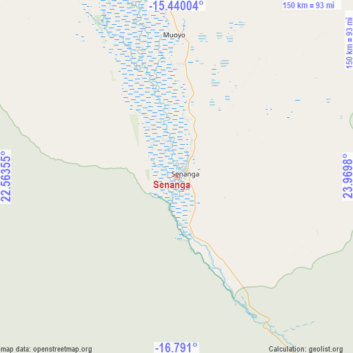
Senanga GPS coordinates[2]
16° 7' 0.012" South, 23° 16' 0.012" East
| Map corner | latitude | longitude |
|---|---|---|
| Upper-left | -15.44004°, | 22.56355° |
| Center: | -16.11667°, | 23.26667° |
| Lower-right: | -16.791°, | 23.9698° |
| Map W x H: | 150.2×150.2 km | = 93.3×93.3mi |
| max Lat: | -8.46887° ⇑87.9% North |
| Senanga: | -16.11667° |
| min Lat: | ⇓12.1% South -17.84194° |
| min Long | Senanga | max Long |
| 22.67926° | 23.26667° | 33.1782° |
| W 7.6%⇐ | ⇒92.4% E |
Elevation
Elevation of Senanga is 1001 m = 3284 ft, and this is 142.4 m = 467 ft below average elevation for this country.
| Max E: |
1622 m = 5322 ft | 78.8% |
| Avg. | 1143.4 m = 3751 ft | |
| Senanga | 1001 m = 3284 ft | |
Min E: |
328 m = 1076 ft | 21.2% |
See also: Zambia elevation on elevation.city.
Geographical zone
Senanga is located in South Torrid zone (between Equator and Tropic of Capricorn). Distance of this Southern Tropic circle is 813.9 km =505.7 mi to South.| Distance of | km | miles | from Senanga |
|---|---|---|---|
| Equator | 1792 | 1113.5 | to North |
| Tropic Capricorn | 813.9 | 505.7 | to South |
| Antarctic Circle | 5609.2 | 3485.4 | to South |
| South Pole | 8215.1 | 5104.6 | to South |


Nearby cities:
15 places around Senanga: (largest is in red/bold)
• Choma
404.1 km =251.1 mi,  100°
100°
• Kabompo
298.1 km =185.2 mi,  19°
19°
• Kalabo
139.9 km =86.9 mi,  333°
333°
• Kalengwa
348.9 km =216.8 mi,  32°
32°
• Kaoma
221.3 km =137.5 mi,  47°
47°
• Kasempa
404.4 km =251.3 mi,  43°
43°
• Limulunga
114.2 km =71 mi,  353°
353°
• Livingstone
335.4 km =208.4 mi,  124°
124°
• Lukulu
194.2 km =120.7 mi,  359°
359°
• Mongu
97.7 km =60.7 mi, 351°
• Mufumbwe
316.8 km =196.9 mi, 31°
• Mumbwa
425.6 km =264.5 mi,  72°
72°
• Namwala
341.5 km =212.2 mi,  83°
83°
• Sesheke
186.7 km =116 mi,  144°
144°
• Zambezi
286.7 km =178.1 mi, 356°
Sources, notices
• [Note1] Compared only with cities in Zambia existing in our database
• [Src1] Map data: © OpenStreetMap contributors (CC-BY-SA)
• [Src2] Other city data from geonames.org with taken over terms of usage.
• [Src3] Geographical zone / Annual Mean Temperature by Robert A. Rohde @ Wikipedia
