Limulunga geodata
Limulunga (Western) is a populated place; located in Zambia in Africa/Lusaka (GMT+2) time zone. With population of 7,461 people, there are 47 cities with bigger population in this country. Compared to other cities in Zambia, 74.2% of cities are located further ↑North; 95.5% of cities are located further →East and 74.2% of cities have higher elevation than Limulunga. Note1


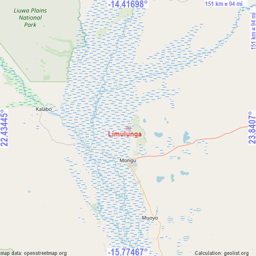
Limulunga GPS coordinates[2]
15° 5' 48.876" South, 23° 8' 15.252" East
| Map corner | latitude | longitude |
|---|---|---|
| Upper-left | -14.41698°, | 22.43445° |
| Center: | -15.09691°, | 23.13757° |
| Lower-right: | -15.77467°, | 23.8407° |
| Map W x H: | 151×151 km | = 93.8×93.8mi |
| max Lat: | -8.46887° ⇑74.2% North |
| Limulunga: | -15.09691° |
| min Lat: | ⇓25.8% South -17.84194° |
| min Long | Limulunga | max Long |
| 22.67926° | 23.13757° | 33.1782° |
| W 4.5%⇐ | ⇒95.5% E |
Elevation
Elevation of Limulunga is 1023 m = 3356 ft, and this is 120.4 m = 395 ft below average elevation for this country.
| Max E: |
1622 m = 5322 ft | 74.2% |
| Avg. | 1143.4 m = 3751 ft | |
| Limulunga | 1023 m = 3356 ft | |
Min E: |
328 m = 1076 ft | 25.8% |
See also: Zambia elevation on elevation.city.
Geographical zone
Limulunga is located in South Torrid zone (between Equator and Tropic of Capricorn). Distance of this Southern Tropic circle is 927.3 km =576.2 mi to South.| Distance of | km | miles | from Limulunga |
|---|---|---|---|
| Equator | 1678.6 | 1043 | to North |
| Tropic Capricorn | 927.3 | 576.2 | to South |
| Antarctic Circle | 5722.6 | 3555.9 | to South |
| South Pole | 8328.4 | 5175 | to South |


Nearby cities:
15 places around Limulunga: (largest is in red/bold)
• Kabompo
202.7 km =126 mi,  34°
34°
• Kalabo
50.5 km =31.4 mi,  283°
283°
• Kalengwa
270.7 km =168.2 mi,  47°
47°
• Kaoma
182 km =113.1 mi,  78°
78°
• Kasempa
342.9 km =213.1 mi,  57°
57°
• Livingstone
420.8 km =261.5 mi,  136°
136°
• Lukulu
81.5 km =50.6 mi,  7°
7°
• Mongu
16.9 km =10.5 mi,  183°
183°
• Mufumbwe
238.2 km =148 mi, 48°
• Mumbwa
421.6 km =262 mi,  88°
88°
• Mwinilunga
399 km =247.9 mi,  20°
20°
• Namwala
361.2 km =224.4 mi,  101°
101°
• Senanga
114.2 km =71 mi,  173°
173°
• Sesheke
292 km =181.4 mi,  154°
154°
• Zambezi
172.8 km =107.4 mi,  358°
358°
Sources, notices
• [Note1] Compared only with cities in Zambia existing in our database
• [Src1] Map data: © OpenStreetMap contributors (CC-BY-SA)
• [Src2] Other city data from geonames.org with taken over terms of usage.
• [Src3] Geographical zone / Annual Mean Temperature by Robert A. Rohde @ Wikipedia
