Solwezi geodata
Solwezi (North-Western) is a seat of a first-order administrative division; located in Zambia in Africa/Lusaka (GMT+2) time zone. With population of 4,846 people, there are 55 cities with bigger population in this country. Compared to other cities in Zambia, 69.7% of cities are located further ↓South; 78.8% of cities are located further →East and 86.4% of cities have lower elevation than Solwezi. Note1


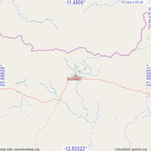
Solwezi GPS coordinates[2]
12° 10' 7.68" South, 26° 23' 21.768" East
| Map corner | latitude | longitude |
|---|---|---|
| Upper-left | -11.4806°, | 25.68626° |
| Center: | -12.1688°, | 26.38938° |
| Lower-right: | -12.85522°, | 27.09251° |
| Map W x H: | 152.8×152.8 km | = 94.9×94.9mi |
| max Lat: | -8.46887° ⇑30.3% North |
| Solwezi: | -12.1688° |
| min Lat: | ⇓69.7% South -17.84194° |
| min Long | Solwezi | max Long |
| 22.67926° | 26.38938° | 33.1782° |
| W 21.2%⇐ | ⇒78.8% E |
Elevation
Elevation of Solwezi is 1381 m = 4531 ft, and this is 237.6 m = 780 ft above average elevation for this country.
| Max E: |
1622 m = 5322 ft | 13.6% |
| Solwezi | 1381 m 4531 ft | |
| Avg. | 1143.4 m = 3751 ft | |
Min E: |
328 m = 1076 ft | 86.4% |
See also: Zambia elevation on elevation.city.
Geographical zone
Solwezi is located in South Torrid zone (between Equator and Tropic of Capricorn). Distance of this Southern Tropic circle is 1252.9 km =778.5 mi to South.| Distance of | km | miles | from Solwezi |
|---|---|---|---|
| Equator | 1353 | 840.7 | to North |
| Tropic Capricorn | 1252.9 | 778.5 | to South |
| Antarctic Circle | 6048.1 | 3758.1 | to South |
| South Pole | 8654 | 5377.3 | to South |


Nearby cities:
15 places around Solwezi: (largest is in red/bold)
• Chambishi
187.9 km =116.8 mi,  105°
105°
• Chililabombwe
157.3 km =97.7 mi,  97°
97°
• Chingola
167.2 km =103.9 mi, 103°
• Kabompo
285.2 km =177.2 mi,  236°
236°
• Kalengwa
208.3 km =129.4 mi,  226°
226°
• Kalulushi
199.7 km =124.1 mi, 112°
• Kansanshi
9.2 km =5.7 mi,  26°
26°
• Kasempa
155.5 km =96.6 mi,  202°
202°
• Kitwe
210.2 km =130.6 mi, 109°
• Luanshya
244.8 km =152.1 mi,  116°
116°
• Mpongwe
242.6 km =150.7 mi,  127°
127°
• Mufulira
205.5 km =127.7 mi, 101°
• Mufumbwe
240.9 km =149.7 mi, 225°
• Mwinilunga
218.6 km =135.8 mi,  282°
282°
• Ndola
259.2 km =161.1 mi, 109°
Sources, notices
• [Note1] Compared only with cities in Zambia existing in our database
• [Src1] Map data: © OpenStreetMap contributors (CC-BY-SA)
• [Src2] Other city data from geonames.org with taken over terms of usage.
• [Src3] Geographical zone / Annual Mean Temperature by Robert A. Rohde @ Wikipedia
