Mongu geodata
Mongu (Western) is a seat of a first-order administrative division; located in Zambia in Africa/Lusaka (GMT+2) time zone. With population of 52,534 people, there are 13 cities with bigger population in this country. Compared to other cities in Zambia, 75.8% of cities are located further ↑North; 97% of cities are located further →East and 75.8% of cities have higher elevation than Mongu. Note1


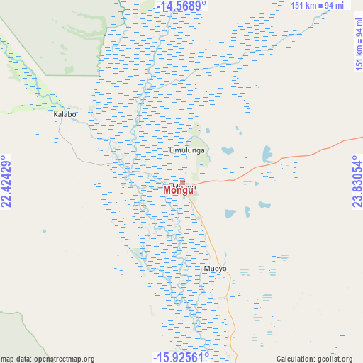
Mongu GPS coordinates[2]
15° 14' 54.06" South, 23° 7' 38.676" East
| Map corner | latitude | longitude |
|---|---|---|
| Upper-left | -14.5689°, | 22.42429° |
| Center: | -15.24835°, | 23.12741° |
| Lower-right: | -15.92561°, | 23.83054° |
| Map W x H: | 150.9×150.9 km | = 93.8×93.8mi |
| max Lat: | -8.46887° ⇑75.8% North |
| Mongu: | -15.24835° |
| min Lat: | ⇓24.2% South -17.84194° |
| min Long | Mongu | max Long |
| 22.67926° | 23.12741° | 33.1782° |
| W 3%⇐ | ⇒97% E |
Elevation
Elevation of Mongu is 1016 m = 3333 ft, and this is 127.4 m = 418 ft below average elevation for this country.
| Max E: |
1622 m = 5322 ft | 75.8% |
| Avg. | 1143.4 m = 3751 ft | |
| Mongu | 1016 m = 3333 ft | |
Min E: |
328 m = 1076 ft | 24.2% |
See also: Mongu elevation on elevation.city.
Geographical zone
Mongu is located in South Torrid zone (between Equator and Tropic of Capricorn). Distance of this Southern Tropic circle is 910.5 km =565.8 mi to South.| Distance of | km | miles | from Mongu |
|---|---|---|---|
| Equator | 1695.5 | 1053.5 | to North |
| Tropic Capricorn | 910.5 | 565.8 | to South |
| Antarctic Circle | 5705.7 | 3545.4 | to South |
| South Pole | 8311.6 | 5164.6 | to South |


Nearby cities:
15 places around Mongu: (largest is in red/bold)
• Kabompo
217.4 km =135.1 mi,  32°
32°
• Kalabo
55.9 km =34.7 mi,  300°
300°
• Kalengwa
283 km =175.8 mi,  45°
45°
• Kaoma
186.9 km =116.1 mi,  73°
73°
• Kasempa
353 km =219.3 mi,  55°
55°
• Limulunga
16.9 km =10.5 mi,  3°
3°
• Livingstone
409.4 km =254.4 mi,  134°
134°
• Lukulu
98.4 km =61.1 mi,  7°
7°
• Mufumbwe
250.4 km =155.6 mi, 45°
• Mumbwa
423.4 km =263.1 mi,  86°
86°
• Mwinilunga
415.1 km =257.9 mi,  19°
19°
• Namwala
359.1 km =223.1 mi,  98°
98°
• Senanga
97.7 km =60.7 mi,  171°
171°
• Sesheke
277.3 km =172.3 mi,  153°
153°
• Zambezi
189.6 km =117.8 mi,  359°
359°
Sources, notices
• [Note1] Compared only with cities in Zambia existing in our database
• [Src1] Map data: © OpenStreetMap contributors (CC-BY-SA)
• [Src2] Other city data from geonames.org with taken over terms of usage.
• [Src3] Geographical zone / Annual Mean Temperature by Robert A. Rohde @ Wikipedia
