Kalengwa geodata
Kalengwa (North-Western) is a populated place; located in Zambia in Africa/Lusaka (GMT+2) time zone. With population of 7,574 people, there are 46 cities with bigger population in this country. Compared to other cities in Zambia, 51.5% of cities are located further ↓South; 83.3% of cities are located further →East and 56.1% of cities have lower elevation than Kalengwa. Note1


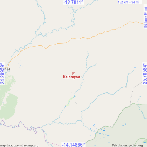
Kalengwa GPS coordinates[2]
13° 27' 57.096" South, 25° 0' 9.756" East
| Map corner | latitude | longitude |
|---|---|---|
| Upper-left | -12.7811°, | 24.29959° |
| Center: | -13.46586°, | 25.00271° |
| Lower-right: | -14.14866°, | 25.70584° |
| Map W x H: | 152.1×152.1 km | = 94.5×94.5mi |
| max Lat: | -8.46887° ⇑48.5% North |
| Kalengwa: | -13.46586° |
| min Lat: | ⇓51.5% South -17.84194° |
| min Long | Kalengwa | max Long |
| 22.67926° | 25.00271° | 33.1782° |
| W 16.7%⇐ | ⇒83.3% E |
Elevation
Elevation of Kalengwa is 1197 m = 3927 ft, and this is 53.6 m = 176 ft above average elevation for this country.
| Max E: |
1622 m = 5322 ft | 43.9% |
| Kalengwa | 1197 m 3927 ft | |
| Avg. | 1143.4 m = 3751 ft | |
Min E: |
328 m = 1076 ft | 56.1% |
See also: Zambia elevation on elevation.city.
Geographical zone
Kalengwa is located in South Torrid zone (between Equator and Tropic of Capricorn). Distance of this Southern Tropic circle is 1108.7 km =688.9 mi to South.| Distance of | km | miles | from Kalengwa |
|---|---|---|---|
| Equator | 1497.3 | 930.4 | to North |
| Tropic Capricorn | 1108.7 | 688.9 | to South |
| Antarctic Circle | 5903.9 | 3668.5 | to South |
| South Pole | 8509.8 | 5287.7 | to South |


Nearby cities:
15 places around Kalengwa: (largest is in red/bold)
• Chingola
329.1 km =204.5 mi,  71°
71°
• Kabompo
87.8 km =54.6 mi,  260°
260°
• Kalabo
302.6 km =188 mi,  235°
235°
• Kansanshi
217 km =134.8 mi,  45°
45°
• Kaoma
148.1 km =92 mi,  188°
188°
• Kasempa
89.9 km =55.9 mi,  89°
89°
• Limulunga
270.7 km =168.2 mi,  227°
227°
• Lukulu
215 km =133.6 mi, 242°
• Mongu
283 km =175.8 mi, 225°
• Mufumbwe
32.6 km =20.3 mi,  222°
222°
• Mumbwa
278.8 km =173.2 mi,  127°
127°
• Mwinilunga
202.2 km =125.6 mi,  342°
342°
• Namwala
297.3 km =184.7 mi,  148°
148°
• Solwezi
208.3 km =129.4 mi, 46°
• Zambezi
205.4 km =127.6 mi,  267°
267°
Sources, notices
• [Note1] Compared only with cities in Zambia existing in our database
• [Src1] Map data: © OpenStreetMap contributors (CC-BY-SA)
• [Src2] Other city data from geonames.org with taken over terms of usage.
• [Src3] Geographical zone / Annual Mean Temperature by Robert A. Rohde @ Wikipedia
