Mwinilunga geodata
Mwinilunga (North-Western) is a populated place; located in Zambia in Africa/Lusaka (GMT+2) time zone. With population of 13,798 people, there are 32 cities with bigger population in this country. Compared to other cities in Zambia, 75.8% of cities are located further ↓South; 87.9% of cities are located further →East and 84.8% of cities have lower elevation than Mwinilunga. Note1


Mwinilunga GPS coordinates[2]
11° 44' 9.024" South, 24° 25' 45.336" East
| Map corner | latitude | longitude |
|---|---|---|
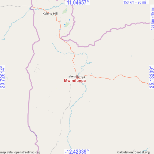
| Upper-left | -11.04657°, | 23.72614° |
| Center: | -11.73584°, | 24.42926° |
| Lower-right: | -12.42339°, | 25.13239° |
| Map W x H: | 153.1×153.1 km | = 95.1×95.1mi |
| max Lat: | -8.46887° ⇑24.2% North |
| Mwinilunga: | -11.73584° |
| min Lat: | ⇓75.8% South -17.84194° |
| min Long | Mwinilunga | max Long |
| 22.67926° | 24.42926° | 33.1782° |
| W 12.1%⇐ | ⇒87.9% E |
Elevation
Elevation of Mwinilunga is 1364 m = 4475 ft, and this is 220.6 m = 724 ft above average elevation for this country.
| Max E: |
1622 m = 5322 ft | 15.2% |
| Mwinilunga | 1364 m 4475 ft | |
| Avg. | 1143.4 m = 3751 ft | |
Min E: |
328 m = 1076 ft | 84.8% |
See also: Zambia elevation on elevation.city.
Geographical zone
Mwinilunga is located in South Torrid zone (between Equator and Tropic of Capricorn). Distance of this Southern Tropic circle is 1301 km =808.4 mi to South.| Distance of | km | miles | from Mwinilunga |
|---|---|---|---|
| Equator | 1304.9 | 810.8 | to North |
| Tropic Capricorn | 1301 | 808.4 | to South |
| Antarctic Circle | 6096.3 | 3788.1 | to South |
| South Pole | 8702.2 | 5407.3 | to South |


Nearby cities:
15 places around Mwinilunga: (largest is in red/bold)
• Chambishi
406.3 km =252.5 mi,  104°
104°
• Chililabombwe
375.6 km =233.4 mi, 100°
• Chingola
385.7 km =239.7 mi, 103°
• Kabompo
207.9 km =129.2 mi,  186°
186°
• Kalabo
408.7 km =254 mi,  207°
207°
• Kalengwa
202.2 km =125.6 mi,  162°
162°
• Kansanshi
221 km =137.3 mi, 100°
• Kaoma
341.2 km =212 mi,  173°
173°
• Kasempa
244.8 km =152.1 mi,  141°
141°
• Limulunga
399 km =247.9 mi,  200°
200°
• Lukulu
319.9 km =198.8 mi, 203°
• Mongu
415.1 km =257.9 mi, 199°
• Mufumbwe
220.2 km =136.8 mi, 169°
• Solwezi
218.6 km =135.8 mi, 102°
• Zambezi
247.1 km =153.5 mi,  215°
215°
Sources, notices
• [Note1] Compared only with cities in Zambia existing in our database
• [Src1] Map data: © OpenStreetMap contributors (CC-BY-SA)
• [Src2] Other city data from geonames.org with taken over terms of usage.
• [Src3] Geographical zone / Annual Mean Temperature by Robert A. Rohde @ Wikipedia
