Chinsali geodata
Chinsali (Muchinga) is a seat of a first-order administrative division; located in Zambia in Africa/Lusaka (GMT+2) time zone. With population of 14,015 people, there are 30 cities with bigger population in this country. Compared to other cities in Zambia, 81.8% of cities are located further ↓South; 90.9% of cities are located further ←West and 71.2% of cities have lower elevation than Chinsali. Note1


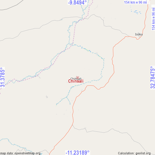
Chinsali GPS coordinates[2]
10° 32' 29.112" South, 32° 4' 53.832" East
| Map corner | latitude | longitude |
|---|---|---|
| Upper-left | -9.8494°, | 31.3785° |
| Center: | -10.54142°, | 32.08162° |
| Lower-right: | -11.23189°, | 32.78475° |
| Map W x H: | 153.7×153.7 km | = 95.5×95.5mi |
| max Lat: | -8.46887° ⇑18.2% North |
| Chinsali: | -10.54142° |
| min Lat: | ⇓81.8% South -17.84194° |
| min Long | Chinsali | max Long |
| 22.67926° | 32.08162° | 33.1782° |
| W 90.9%⇐ | ⇒9.1% E |
Elevation
Elevation of Chinsali is 1286 m = 4219 ft, and this is 142.6 m = 468 ft above average elevation for this country.
| Max E: |
1622 m = 5322 ft | 28.8% |
| Chinsali | 1286 m 4219 ft | |
| Avg. | 1143.4 m = 3751 ft | |
Min E: |
328 m = 1076 ft | 71.2% |
See also: Zambia elevation on elevation.city.
Geographical zone
Chinsali is located in South Torrid zone (between Equator and Tropic of Capricorn). Distance of Equator is 1172.1 km =728.3 mi to North.| Distance of | km | miles | from Chinsali |
|---|---|---|---|
| Equator | 1172.1 | 728.3 | to North |
| Tropic Capricorn | 1433.8 | 890.9 | to South |
| Antarctic Circle | 6229.1 | 3870.6 | to South |
| South Pole | 8835 | 5489.8 | to South |


Nearby cities:
15 places around Chinsali: (largest is in red/bold)
• Chama
138.7 km =86.2 mi,  122°
122°
• Chipata
349.3 km =217 mi,  169°
169°
• Isoka
73.7 km =45.8 mi,  54°
54°
• Kasama
105.1 km =65.3 mi,  290°
290°
• Kataba
291.7 km =181.3 mi,  239°
239°
• Kawambwa
339 km =210.6 mi,  284°
284°
• Lundazi
228.5 km =142 mi,  148°
148°
• Luwingu
237.7 km =147.7 mi, 277°
• Mbala
204.8 km =127.3 mi,  337°
337°
• Mpika
159.3 km =99 mi,  205°
205°
• Mporokoso
250.6 km =155.7 mi,  301°
301°
• Mpulungu
224.5 km =139.5 mi,  331°
331°
• Mungwi
88 km =54.7 mi, 297°
• Nakonde
151.9 km =94.4 mi,  28°
28°
• Samfya
290.5 km =180.5 mi,  251°
251°
Sources, notices
• [Note1] Compared only with cities in Zambia existing in our database
• [Src1] Map data: © OpenStreetMap contributors (CC-BY-SA)
• [Src2] Other city data from geonames.org with taken over terms of usage.
• [Src3] Geographical zone / Annual Mean Temperature by Robert A. Rohde @ Wikipedia
