Isoka geodata
Isoka (Muchinga) is a populated place; located in Zambia in Africa/Lusaka (GMT+2) time zone. With population of 13,122 people, there are 33 cities with bigger population in this country. Compared to other cities in Zambia, 89.4% of cities are located further ↓South; 93.9% of cities are located further ←West and 80.3% of cities have lower elevation than Isoka. Note1


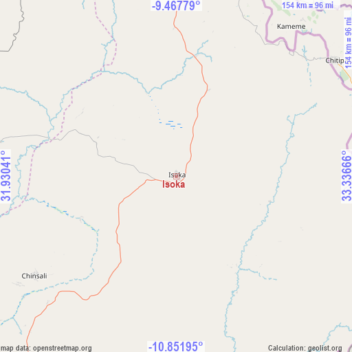
Isoka GPS coordinates[2]
10° 9' 38.232" South, 32° 38' 0.708" East
| Map corner | latitude | longitude |
|---|---|---|
| Upper-left | -9.46779°, | 31.93041° |
| Center: | -10.16062°, | 32.63353° |
| Lower-right: | -10.85195°, | 33.33666° |
| Map W x H: | 153.9×153.9 km | = 95.6×95.6mi |
| max Lat: | -8.46887° ⇑10.6% North |
| Isoka: | -10.16062° |
| min Lat: | ⇓89.4% South -17.84194° |
| min Long | Isoka | max Long |
| 22.67926° | 32.63353° | 33.1782° |
| W 93.9%⇐ | ⇒6.1% E |
Elevation
Elevation of Isoka is 1321 m = 4334 ft, and this is 177.6 m = 583 ft above average elevation for this country.
| Max E: |
1622 m = 5322 ft | 19.7% |
| Isoka | 1321 m 4334 ft | |
| Avg. | 1143.4 m = 3751 ft | |
Min E: |
328 m = 1076 ft | 80.3% |
See also: Zambia elevation on elevation.city.
Geographical zone
Isoka is located in South Torrid zone (between Equator and Tropic of Capricorn). Distance of Equator is 1129.8 km =702 mi to North.| Distance of | km | miles | from Isoka |
|---|---|---|---|
| Equator | 1129.8 | 702 | to North |
| Tropic Capricorn | 1476.2 | 917.3 | to South |
| Antarctic Circle | 6271.4 | 3896.9 | to South |
| South Pole | 8877.3 | 5516.1 | to South |


Nearby cities:
15 places around Isoka: (largest is in red/bold)
• Chama
130 km =80.8 mi,  154°
154°
• Chinsali
73.7 km =45.8 mi,  234°
234°
• Chipata
386.1 km =239.9 mi,  179°
179°
• Kaputa
376.4 km =233.9 mi,  299°
299°
• Kasama
159.1 km =98.9 mi,  267°
267°
• Kataba
365.3 km =227 mi,  238°
238°
• Lundazi
244.4 km =151.9 mi,  165°
165°
• Luwingu
296.4 km =184.2 mi, 267°
• Mbala
202.2 km =125.6 mi,  316°
316°
• Mpika
226.4 km =140.7 mi,  214°
214°
• Mporokoso
288.5 km =179.3 mi,  287°
287°
• Mpulungu
227.9 km =141.6 mi,  313°
313°
• Mungwi
138.4 km =86 mi, 269°
• Nakonde
91.8 km =57 mi,  7°
7°
• Samfya
361.8 km =224.8 mi,  248°
248°
Sources, notices
• [Note1] Compared only with cities in Zambia existing in our database
• [Src1] Map data: © OpenStreetMap contributors (CC-BY-SA)
• [Src2] Other city data from geonames.org with taken over terms of usage.
• [Src3] Geographical zone / Annual Mean Temperature by Robert A. Rohde @ Wikipedia
