Mhangura geodata
Mhangura (Mashonaland West) is a populated place; located in Zimbabwe in Africa/Harare (GMT+2) time zone. With population of 6,503 people, there are 39 cities with bigger population in this country. Compared to other cities in Zimbabwe, 92.3% of cities are located further ↓South; 58.5% of cities are located further →East and 55.4% of cities have higher elevation than Mhangura. Note1


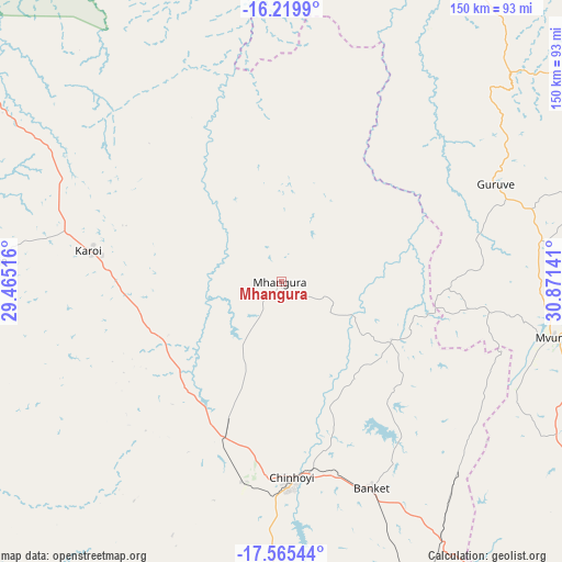
Mhangura GPS coordinates[2]
16° 53' 37.932" South, 30° 10' 5.808" East
| Map corner | latitude | longitude |
|---|---|---|
| Upper-left | -16.2199°, | 29.46516° |
| Center: | -16.89387°, | 30.16828° |
| Lower-right: | -17.56544°, | 30.87141° |
| Map W x H: | 149.6×149.6 km | = 93×93mi |
| max Lat: | -16.03333° ⇑7.7% North |
| Mhangura: | -16.89387° |
| min Lat: | ⇓92.3% South -22.21667° |
| min Long | Mhangura | max Long |
| 25.83066° | 30.16828° | 32.86667° |
| W 41.5%⇐ | ⇒58.5% E |
Elevation
Elevation of Mhangura is 1182 m = 3878 ft, and this is 15.7 m = 52 ft below average elevation for this country.
| Max E: |
1706 m = 5597 ft | 55.4% |
| Avg. | 1197.7 m = 3929 ft | |
| Mhangura | 1182 m = 3878 ft | |
Min E: |
402 m = 1319 ft | 44.6% |
See also: Zimbabwe elevation on elevation.city.
Geographical zone
Mhangura is located in South Torrid zone (between Equator and Tropic of Capricorn). Distance of this Southern Tropic circle is 727.5 km =452 mi to South.| Distance of | km | miles | from Mhangura |
|---|---|---|---|
| Equator | 1878.4 | 1167.2 | to North |
| Tropic Capricorn | 727.5 | 452 | to South |
| Antarctic Circle | 5522.8 | 3431.7 | to South |
| South Pole | 8128.6 | 5050.9 | to South |


Nearby cities:
15 places around Mhangura: (largest is in red/bold)
• Banket
59.7 km =37.1 mi,  155°
155°
• Bindura
131.6 km =81.8 mi,  110°
110°
• Centenary
102.5 km =63.7 mi,  79°
79°
• Chakari
133.2 km =82.8 mi,  192°
192°
• Chegutu
137.5 km =85.4 mi,  181°
181°
• Chinhoyi
52.7 km =32.7 mi, 176°
• Concession
99.3 km =61.7 mi,  123°
123°
• Glendale
108.4 km =67.4 mi, 118°
• Harare
140 km =87 mi,  137°
137°
• Karoi
51.5 km =32 mi,  280°
280°
• Madziwa
145.2 km =90.2 mi,  91°
91°
• Mazowe
109.2 km =67.9 mi,  128°
128°
• Mvurwi
74.1 km =46 mi,  102°
102°
• Norton
123.6 km =76.8 mi,  152°
152°
• Raffingora
32.2 km =20 mi, 118°
Sources, notices
• [Note1] Compared only with cities in Zimbabwe existing in our database
• [Src1] Map data: © OpenStreetMap contributors (CC-BY-SA)
• [Src2] Other city data from geonames.org with taken over terms of usage.
• [Src3] Geographical zone / Annual Mean Temperature by Robert A. Rohde @ Wikipedia
