Chirundu geodata
Chirundu (Mashonaland West) is a populated place; located in Zimbabwe in Africa/Harare (GMT+2) time zone. With population of 1,911 people, there are 57 cities with bigger population in this country. Compared to other cities in Zimbabwe, 100% of cities are located further ↓South; 84.6% of cities are located further →East and 100% of cities have higher elevation than Chirundu. Note1


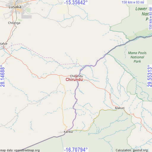
Chirundu GPS coordinates[2]
16° 1' 59.988" South, 28° 51' 0" East
| Map corner | latitude | longitude |
|---|---|---|
| Upper-left | -15.35642°, | 28.14688° |
| Center: | -16.03333°, | 28.85° |
| Lower-right: | -16.70794°, | 29.55313° |
| Map W x H: | 150.3×150.3 km | = 93.4×93.4mi |
| max Lat: | -16.03333° ⇑0% North |
| Chirundu: | -16.03333° |
| min Lat: | ⇓100% South -22.21667° |
| min Long | Chirundu | max Long |
| 25.83066° | 28.85° | 32.86667° |
| W 15.4%⇐ | ⇒84.6% E |
Elevation
Elevation of Chirundu is 402 m = 1319 ft, and this is 795.7 m = 2611 ft below average elevation for this country.
| Max E: |
1706 m = 5597 ft | 100% |
| Avg. | 1197.7 m = 3929 ft | |
| Chirundu | 402 m = 1319 ft | |
Min E: |
402 m = 1319 ft | 0% |
See also: Zimbabwe elevation on elevation.city.
Geographical zone
Chirundu is located in South Torrid zone (between Equator and Tropic of Capricorn). Distance of this Southern Tropic circle is 823.2 km =511.5 mi to South.| Distance of | km | miles | from Chirundu |
|---|---|---|---|
| Equator | 1782.7 | 1107.7 | to North |
| Tropic Capricorn | 823.2 | 511.5 | to South |
| Antarctic Circle | 5618.4 | 3491.1 | to South |
| South Pole | 8224.3 | 5110.3 | to South |


Nearby cities:
15 places around Chirundu: (largest is in red/bold)
• Banket
223.1 km =138.6 mi,  132°
132°
• Binga
238.6 km =148.3 mi,  222°
222°
• Centenary
253.5 km =157.5 mi,  107°
107°
• Chakari
251.4 km =156.2 mi,  153°
153°
• Chegutu
270.5 km =168.1 mi, 149°
• Chinhoyi
206.5 km =128.3 mi,  135°
135°
• Concession
269.3 km =167.3 mi,  123°
123°
• Glendale
278.1 km =172.8 mi, 121°
• Gokwe
241.6 km =150.1 mi,  177°
177°
• Kariba
54 km =33.6 mi,  185°
185°
• Karoi
124.6 km =77.4 mi, 133°
• Mazowe
279 km =173.4 mi, 125°
• Mhangura
170 km =105.6 mi, 124°
• Mvurwi
240.4 km =149.4 mi, 117°
• Raffingora
202.1 km =125.6 mi, 123°
Sources, notices
• [Note1] Compared only with cities in Zimbabwe existing in our database
• [Src1] Map data: © OpenStreetMap contributors (CC-BY-SA)
• [Src2] Other city data from geonames.org with taken over terms of usage.
• [Src3] Geographical zone / Annual Mean Temperature by Robert A. Rohde @ Wikipedia
