Khandūd geodata
Khandūd (Badakhshan) is a seat of a second-order administrative division; located in Afghanistan in Asia/Kabul (GMT+4.5) time zone. With population of 5,521 people, there are 85 cities with bigger population in this country. Compared to other cities in Afghanistan, 90.4% of cities are located further ↓South; 100% of cities are located further ←West and 99% of cities have lower elevation than Khandūd. Note1


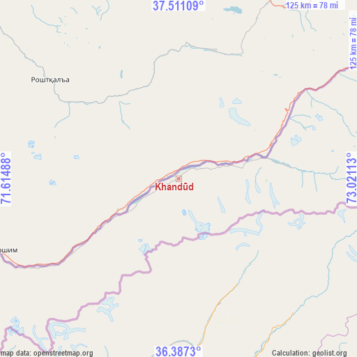
Khandūd GPS coordinates[2]
36° 57' 4.572" North, 72° 19' 4.8" East
| Map corner | latitude | longitude |
|---|---|---|
| Upper-left | 37.51109°, | 71.61488° |
| Center: | 36.95127°, | 72.318° |
| Lower-right: | 36.3873°, | 73.02113° |
| Map W x H: | 125×125 km | = 77.7×77.7mi |
| max Lat: | 38.4435° ⇑9.6% North |
| Khandūd: | 36.95127° |
| min Lat: | ⇓90.4% South 30.15° |
| min Long | Khandūd | max Long |
| 61.06667° | 72.318° | 72.318° |
| W 100%⇐ | ⇒0% E |
Elevation
Elevation of Khandūd is 2807 m = 9209 ft, and this is 1388.6 m = 4556 ft above average elevation for this country.
| Max E: |
3068 m = 10066 ft | 1% |
| Khandūd | 2807 m 9209 ft | |
| Avg. | 1418.4 m = 4654 ft | |
Min E: |
254 m = 833 ft | 99% |
See also: Afghanistan elevation on elevation.city.
Geographical zone
Khandūd is located in North temperate zone (between Tropic of Cancer and the Arctic Circle). Distance of this Northern Tropic circle is 1502.7 km =933.7 mi to South.| Distance of | km | miles | from Khandūd |
|---|---|---|---|
| North Pole | 5898.5 | 3665.2 | to North |
| Arctic Circle | 3292.6 | 2045.9 | to North |
| Tropic Cancer | 1502.7 | 933.7 | to South |
| Equator | 4108.6 | 2553 | to South |


Nearby cities:
15 places around Khandūd: (largest is in red/bold)
• Ashkāsham
75.9 km =47.2 mi,  246°
246°
• Bahārak
125.5 km =78 mi,  272°
272°
• Barg-e Matāl
166.8 km =103.6 mi,  211°
211°
• Chākarān
111.1 km =69 mi, 267°
• Darāyim
172.3 km =107.1 mi, 266°
• Fayzabad
155.4 km =96.6 mi,  276°
276°
• Ghurayd Gharamē
144.2 km =89.6 mi, 250°
• Jurm
132.3 km =82.2 mi, 265°
• Kuran wa Munjan
172.1 km =106.9 mi,  233°
233°
• March
177.5 km =110.3 mi,  291°
291°
• Pas Pul
161.5 km =100.4 mi, 291°
• Shahrān
140.3 km =87.2 mi, 271°
• Zaybāk
98.6 km =61.3 mi,  241°
241°
• Zīrakī
171.2 km =106.4 mi, 294°
• Ḩāfiz̧ Moghul
170.7 km =106.1 mi, 273°
Sources, notices
• [Note1] Compared only with cities in Afghanistan existing in our database
• [Src1] Map data: © OpenStreetMap contributors (CC-BY-SA)
• [Src2] Other city data from geonames.org with taken over terms of usage.
• [Src3] Geographical zone / Annual Mean Temperature by Robert A. Rohde @ Wikipedia
