Daifam geodata
Daifam (Samdrup Jongkhar) is a populated place; located in Bhutan in Asia/Thimphu (GMT+6) time zone. With population of 662 people, there are 23 cities with bigger population in this country. Compared to other cities in Bhutan, 74.1% of cities are located further ↑North; 100% of cities are located further ←West and 77.8% of cities have higher elevation than Daifam. Note1


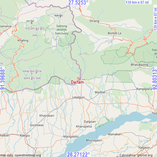
Daifam GPS coordinates[2]
26° 54' 0" North, 92° 6' 0" East
| Map corner | latitude | longitude |
|---|---|---|
| Upper-left | 27.5253°, | 91.39688° |
| Center: | 26.9°, | 92.1° |
| Lower-right: | 26.27122°, | 92.80313° |
| Map W x H: | 139.4×139.4 km | = 86.6×86.6mi |
| max Lat: | 27.90372° ⇑74.1% North |
| Daifam: | 26.9° |
| min Lat: | ⇓25.9% South 26.78333° |
| min Long | Daifam | max Long |
| 89.09951° | 92.1° | 92.1° |
| W 100%⇐ | ⇒0% E |
Elevation
Elevation of Daifam is 346 m = 1135 ft, and this is 1032.2 m = 3386 ft below average elevation for this country.
| Max E: |
2761 m = 9058 ft | 77.8% |
| Avg. | 1378.2 m = 4522 ft | |
| Daifam | 346 m = 1135 ft | |
Min E: |
145 m = 476 ft | 22.2% |
See also: Bhutan elevation on elevation.city.
Geographical zone
Daifam is located in North temperate zone (between Tropic of Cancer and the Arctic Circle). Distance of this Northern Tropic circle is 385.1 km =239.3 mi to South.| Distance of | km | miles | from Daifam |
|---|---|---|---|
| North Pole | 7016.1 | 4359.6 | to North |
| Arctic Circle | 4410.2 | 2740.4 | to North |
| Tropic Cancer | 385.1 | 239.3 | to South |
| Equator | 2991 | 1858.5 | to South |


Nearby cities:
15 places around Daifam: (largest is in red/bold)
• Bhangtar
39.1 km =24.3 mi,  256°
256°
• Daga
221.1 km =137.4 mi,  275°
275°
• Jakar
151.5 km =94.1 mi,  298°
298°
• Lhuentse
124.4 km =77.3 mi,  313°
313°
• Mongar
94.8 km =58.9 mi, 296°
• Nganglam
85.3 km =53 mi, 261°
• Panbang
110.8 km =68.8 mi,  268°
268°
• Pemagatshel
70.7 km =43.9 mi, 282°
• Samdrup Jongkhar
60 km =37.3 mi, 259°
• Sarpang
181.8 km =113 mi, 268°
• Shemgang
147.1 km =91.4 mi, 283°
• Trashi Yangtse
99 km =61.5 mi,  323°
323°
• Trashigang
72.4 km =45 mi, 311°
• Trongsa
171.2 km =106.4 mi,  293°
293°
• Tsirang
196.4 km =122 mi, 273°
Sources, notices
• [Note1] Compared only with cities in Bhutan existing in our database
• [Src1] Map data: © OpenStreetMap contributors (CC-BY-SA)
• [Src2] Other city data from geonames.org with taken over terms of usage.
• [Src3] Geographical zone / Annual Mean Temperature by Robert A. Rohde @ Wikipedia
