Kuli geodata
Kuli (Ghanzi) is a populated place; located in Botswana in Africa/Gaborone (GMT+2) time zone. With population of 819 people, there are 93 cities with bigger population in this country. Compared to other cities in Botswana, 51.4% of cities are located further ↓South; 100% of cities are located further →East and 96.2% of cities have lower elevation than Kuli. Note1


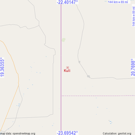
Kuli GPS coordinates[2]
23° 3' 0" South, 20° 4' 0.012" East
| Map corner | latitude | longitude |
|---|---|---|
| Upper-left | -22.40147°, | 19.36355° |
| Center: | -23.05°, | 20.06667° |
| Lower-right: | -23.69542°, | 20.7698° |
| Map W x H: | 143.9×143.9 km | = 89.4×89.4mi |
| max Lat: | -17.80165° ⇑48.6% North |
| Kuli: | -23.05° |
| min Lat: | ⇓51.4% South -26.9° |
| min Long | Kuli | max Long |
| 20.06667° | 20.06667° | 28.74946° |
| W 0%⇐ | ⇒100% E |
Elevation
Elevation of Kuli is 1290 m = 4232 ft, and this is 275 m = 902 ft above average elevation for this country.
| Max E: |
1406 m = 4613 ft | 3.8% |
| Kuli | 1290 m 4232 ft | |
| Avg. | 1015 m = 3330 ft | |
Min E: |
676 m = 2218 ft | 96.2% |
See also: Botswana elevation on elevation.city.
Geographical zone
Kuli is located in South Torrid zone (between Equator and Tropic of Capricorn). Distance of this Southern Tropic circle is 43 km =26.7 mi to South.| Distance of | km | miles | from Kuli |
|---|---|---|---|
| Equator | 2562.9 | 1592.5 | to North |
| Tropic Capricorn | 43 | 26.7 | to South |
| Antarctic Circle | 4838.3 | 3006.4 | to South |
| South Pole | 7444.1 | 4625.5 | to South |


Nearby cities:
15 places around Kuli: (largest is in red/bold)
• Dekar
255.6 km =158.8 mi,  48°
48°
• Dutlwe
404.4 km =251.3 mi,  104°
104°
• Ghanzi
221.3 km =137.5 mi, 47°
• Hukuntsi
204 km =126.8 mi,  121°
121°
• Kang
286.3 km =177.9 mi, 104°
• Khakhea
393.3 km =244.4 mi, 117°
• Lehututu
209.9 km =130.4 mi, 119°
• Lokwabe
218.7 km =135.9 mi, 124°
• Manyana
173 km =107.5 mi, 102°
• Sehithwa
396.7 km =246.5 mi,  43°
43°
• Toteng
420.2 km =261.1 mi, 45°
• Tsau
405.8 km =252.2 mi, 37°
• Tshabong
411.5 km =255.7 mi,  144°
144°
• Tshane
216.5 km =134.5 mi, 120°
• Werda
408.9 km =254.1 mi,  127°
127°
Sources, notices
• [Note1] Compared only with cities in Botswana existing in our database
• [Src1] Map data: © OpenStreetMap contributors (CC-BY-SA)
• [Src2] Other city data from geonames.org with taken over terms of usage.
• [Src3] Geographical zone / Annual Mean Temperature by Robert A. Rohde @ Wikipedia
