Catamayo geodata
Catamayo (Loja) is a populated place; located in Ecuador in America/Guayaquil (GMT-5) time zone. With population of 18,565 people, there are 52 cities with bigger population in this country. Compared to other cities in Ecuador, 95% of cities are located further ↑North; 52.1% of cities are located further ←West and 68.6% of cities have lower elevation than Catamayo. Note1


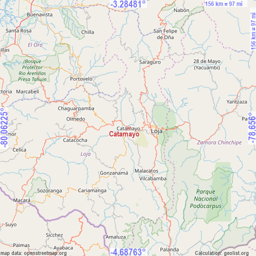
Catamayo GPS coordinates[2]
3° 59' 11.472" South, 79° 21' 32.832" West
| Map corner | latitude | longitude |
|---|---|---|
| Upper-left | -3.28481°, | -80.06225° |
| Center: | -3.98652°, | -79.35912° |
| Lower-right: | -4.68763°, | -78.656° |
| Map W x H: | 156×156 km | = 96.9×96.9mi |
| max Lat: | 1.35251° ⇑95% North |
| Catamayo: | -3.98652° |
| min Lat: | ⇓5% South -4.38181° |
| min Long | Catamayo | max Long |
| -90.96654° | -79.35912° | -76.89528° |
| W 52.1%⇐ | ⇒47.9% E |
Elevation
Elevation of Catamayo is 1268 m = 4160 ft, and this is 322.9 m = 1059 ft above average elevation for this country.
| Max E: |
3131 m = 10272 ft | 31.4% |
| Catamayo | 1268 m 4160 ft | |
| Avg. | 945.1 m = 3101 ft | |
Min E: |
1 m = 3 ft | 68.6% |
See also: Ecuador elevation on elevation.city.
Geographical zone
Catamayo is located in South Torrid zone (between Equator and Tropic of Capricorn). Distance of Equator is 443.3 km =275.5 mi to North.| Distance of | km | miles | from Catamayo |
|---|---|---|---|
| Equator | 443.3 | 275.5 | to North |
| Tropic Capricorn | 2162.7 | 1343.8 | to South |
| Antarctic Circle | 6957.9 | 4323.4 | to South |
| South Pole | 9563.8 | 5942.7 | to South |


Nearby cities:
15 places around Catamayo: (largest is in red/bold)
• Cariamanga
43.8 km =27.2 mi,  209°
209°
• Catacocha
33 km =20.5 mi,  257°
257°
• Celica
67.5 km =41.9 mi, 258°
• Gualaquiza
107.9 km =67 mi,  53°
53°
• Loja
17.2 km =10.7 mi,  92°
92°
• Macará
78.3 km =48.7 mi,  235°
235°
• Machala
104.9 km =65.2 mi,  320°
320°
• Pasaje
88.7 km =55.1 mi,  325°
325°
• Piñas
49.3 km =30.6 mi,  313°
313°
• Portovelo
41.5 km =25.8 mi, 315°
• Puerto Bolívar
106.9 km =66.4 mi, 318°
• Santa Rosa
89.5 km =55.6 mi, 311°
• Yantzaza
68.5 km =42.6 mi,  75°
75°
• Zamora
45.7 km =28.4 mi,  101°
101°
• Zaruma
43.2 km =26.8 mi, 319°
Sources, notices
• [Note1] Compared only with cities in Ecuador existing in our database
• [Src1] Map data: © OpenStreetMap contributors (CC-BY-SA)
• [Src2] Other city data from geonames.org with taken over terms of usage.
• [Src3] Geographical zone / Annual Mean Temperature by Robert A. Rohde @ Wikipedia
