Mek'ele geodata
Mek'ele (Tigray) is a seat of a first-order administrative division; located in Ethiopia in Africa/Addis_Ababa (GMT+3) time zone. With population of 215,546 people, there are 2 cities with bigger population in this country. Compared to other cities in Ethiopia, 97.2% of cities are located further ↓South; 74.8% of cities are located further ←West and 64.5% of cities have lower elevation than Mek'ele. Note1


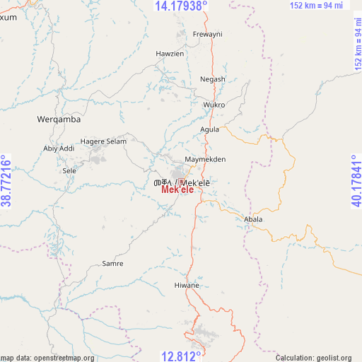
Mek'ele GPS coordinates[2]
13° 29' 48.012" North, 39° 28' 31.008" East
| Map corner | latitude | longitude |
|---|---|---|
| Upper-left | 14.17938°, | 38.77216° |
| Center: | 13.49667°, | 39.47528° |
| Lower-right: | 12.812°, | 40.17841° |
| Map W x H: | 152×152 km | = 94.4×94.4mi |
| max Lat: | 14.277° ⇑2.8% North |
| Mek'ele: | 13.49667° |
| min Lat: | ⇓97.2% South 4.05° |
| min Long | Mek'ele | max Long |
| 34.53333° | 39.47528° | 42.8° |
| W 74.8%⇐ | ⇒25.2% E |
Elevation
Elevation of Mek'ele is 2068 m = 6785 ft, and this is 172.4 m = 566 ft above average elevation for this country.
| Max E: |
2854 m = 9364 ft | 35.5% |
| Mek'ele | 2068 m 6785 ft | |
| Avg. | 1895.6 m = 6219 ft | |
Min E: |
367 m = 1204 ft | 64.5% |
See also: Mek'ele elevation on elevation.city.
Geographical zone
Mek'ele is located in North Torrid zone (between Equator and Tropic of Cancer). Distance of this Northern Tropic circle is 1105.2 km =686.7 mi to North.| Distance of | km | miles | from Mek'ele |
|---|---|---|---|
| North Pole | 8506.4 | 5285.6 | to North |
| Arctic Circle | 5900.5 | 3666.4 | to North |
| Tropic Cancer | 1105.2 | 686.7 | to North |
| Equator | 1500.7 | 932.5 | to South |


Nearby cities:
15 places around Mek'ele: (largest is in red/bold)
• Axum
106.8 km =66.4 mi,  310°
310°
• Dabat
193.7 km =120.4 mi,  252°
252°
• Debark’
174.8 km =108.6 mi,  257°
257°
• Debre Tabor
242 km =150.4 mi,  220°
220°
• Dubti
262.4 km =163 mi,  138°
138°
• Gondar
239.3 km =148.7 mi, 245°
• Inda Silasē
145.3 km =90.3 mi,  297°
297°
• Korem
110.3 km =68.5 mi,  177°
177°
• Lalībela
169.3 km =105.2 mi,  195°
195°
• Maych’ew
79.2 km =49.2 mi,  174°
174°
• Robīt
165.5 km =102.8 mi, 174°
• Semera
251.9 km =156.5 mi, 138°
• Werota
260.7 km =162 mi,  227°
227°
• Ādīgrat
86.8 km =53.9 mi,  359°
359°
• Ādīs Zemen
239.2 km =148.6 mi, 230°
Sources, notices
• [Note1] Compared only with cities in Ethiopia existing in our database
• [Src1] Map data: © OpenStreetMap contributors (CC-BY-SA)
• [Src2] Other city data from geonames.org with taken over terms of usage.
• [Src3] Geographical zone / Annual Mean Temperature by Robert A. Rohde @ Wikipedia
