Ādīgrat geodata
Ādīgrat (Tigray) is a populated place; located in Ethiopia in Africa/Addis_Ababa (GMT+3) time zone. With population of 65,000 people, there are 16 cities with bigger population in this country. Compared to other cities in Ethiopia, 100% of cities are located further ↓South; 73.8% of cities are located further ←West and 79.4% of cities have lower elevation than Ādīgrat. Note1


Ādīgrat GPS coordinates[2]
14° 16' 37.2" North, 39° 27' 43.2" East
| Map corner | latitude | longitude |
|---|---|---|
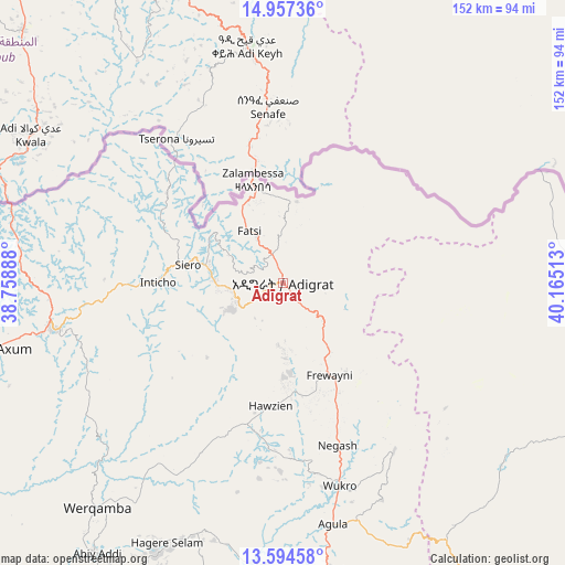
| Upper-left | 14.95736°, | 38.75888° |
| Center: | 14.277°, | 39.462° |
| Lower-right: | 13.59458°, | 40.16513° |
| Map W x H: | 151.5×151.5 km | = 94.1×94.1mi |
| max Lat: | 14.277° ⇑0% North |
| Ādīgrat: | 14.277° |
| min Lat: | ⇓100% South 4.05° |
| min Long | Ādīgrat | max Long |
| 34.53333° | 39.462° | 42.8° |
| W 73.8%⇐ | ⇒26.2% E |
Elevation
Elevation of Ādīgrat is 2451 m = 8041 ft, and this is 555.4 m = 1822 ft above average elevation for this country.
| Max E: |
2854 m = 9364 ft | 20.6% |
| Ādīgrat | 2451 m 8041 ft | |
| Avg. | 1895.6 m = 6219 ft | |
Min E: |
367 m = 1204 ft | 79.4% |
See also: Ādīgrat elevation on elevation.city.
Geographical zone
Ādīgrat is located in North Torrid zone (between Equator and Tropic of Cancer). Distance of this Northern Tropic circle is 1018.5 km =632.9 mi to North.| Distance of | km | miles | from Ādīgrat |
|---|---|---|---|
| North Pole | 8419.6 | 5231.7 | to North |
| Arctic Circle | 5813.7 | 3612.5 | to North |
| Tropic Cancer | 1018.5 | 632.9 | to North |
| Equator | 1587.5 | 986.4 | to South |


Nearby cities:
15 places around Ādīgrat: (largest is in red/bold)
• Axum
81.5 km =50.6 mi,  257°
257°
• Dabat
233 km =144.8 mi,  231°
231°
• Debark’
209.9 km =130.4 mi, 233°
• Debre Tabor
312 km =193.9 mi,  210°
210°
• Dubti
332.9 km =206.9 mi,  148°
148°
• Gondar
285.2 km =177.2 mi, 229°
• Inda Silasē
128.6 km =79.9 mi, 261°
• Korem
197 km =122.4 mi,  178°
178°
• Lalībela
253.6 km =157.6 mi,  190°
190°
• Maych’ew
165.8 km =103 mi, 177°
• Mek'ele
86.8 km =53.9 mi, 179°
• Robīt
252 km =156.6 mi, 175°
• Semera
322.8 km =200.6 mi, 148°
• Werota
324.5 km =201.6 mi,  216°
216°
• Ādīs Zemen
301.2 km =187.2 mi, 217°
Sources, notices
• [Note1] Compared only with cities in Ethiopia existing in our database
• [Src1] Map data: © OpenStreetMap contributors (CC-BY-SA)
• [Src2] Other city data from geonames.org with taken over terms of usage.
• [Src3] Geographical zone / Annual Mean Temperature by Robert A. Rohde @ Wikipedia
