Inda Silasē geodata
Inda Silasē (Tigray) is a populated place; located in Ethiopia in Africa/Addis_Ababa (GMT+3) time zone. With population of 50,078 people, there are 20 cities with bigger population in this country. Compared to other cities in Ethiopia, 98.1% of cities are located further ↓South; 55.1% of cities are located further →East and 50.5% of cities have lower elevation than Inda Silasē. Note1


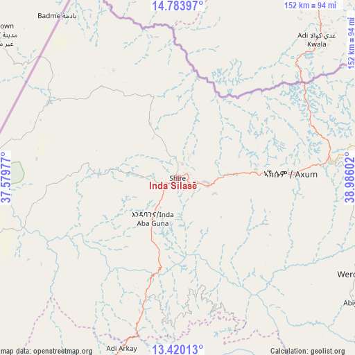
Inda Silasē GPS coordinates[2]
14° 6' 11.052" North, 38° 16' 58.404" East
| Map corner | latitude | longitude |
|---|---|---|
| Upper-left | 14.78397°, | 37.57977° |
| Center: | 14.10307°, | 38.28289° |
| Lower-right: | 13.42013°, | 38.98602° |
| Map W x H: | 151.6×151.6 km | = 94.2×94.2mi |
| max Lat: | 14.277° ⇑1.9% North |
| Inda Silasē: | 14.10307° |
| min Lat: | ⇓98.1% South 4.05° |
| min Long | Inda Silasē | max Long |
| 34.53333° | 38.28289° | 42.8° |
| W 44.9%⇐ | ⇒55.1% E |
Elevation
Elevation of Inda Silasē is 1912 m = 6273 ft, and this is 16.4 m = 54 ft above average elevation for this country.
| Max E: |
2854 m = 9364 ft | 49.5% |
| Inda Silasē | 1912 m 6273 ft | |
| Avg. | 1895.6 m = 6219 ft | |
Min E: |
367 m = 1204 ft | 50.5% |
See also: Inda Silasē elevation on elevation.city.
Geographical zone
Inda Silasē is located in North Torrid zone (between Equator and Tropic of Cancer). Distance of this Northern Tropic circle is 1037.8 km =644.9 mi to North.| Distance of | km | miles | from Inda Silasē |
|---|---|---|---|
| North Pole | 8438.9 | 5243.7 | to North |
| Arctic Circle | 5833.1 | 3624.5 | to North |
| Tropic Cancer | 1037.8 | 644.9 | to North |
| Equator | 1568.1 | 974.4 | to South |


Nearby cities:
15 places around Inda Silasē: (largest is in red/bold)
• Addiet Canna
327.1 km =203.3 mi,  195°
195°
• Axum
47.5 km =29.5 mi,  87°
87°
• Bahir Dar
295.3 km =183.5 mi, 199°
• Dabat
136.4 km =84.8 mi, 204°
• Debark’
113.2 km =70.3 mi, 201°
• Debre Tabor
252.2 km =156.7 mi,  186°
186°
• Gondar
189 km =117.4 mi,  207°
207°
• Korem
222.6 km =138.3 mi,  142°
142°
• Lalībela
244.7 km =152 mi,  160°
160°
• Maych’ew
199.9 km =124.2 mi, 137°
• Mek'ele
145.3 km =90.3 mi,  117°
117°
• Robīt
274.2 km =170.4 mi,  147°
147°
• Werota
251.2 km =156.1 mi, 194°
• Ādīgrat
128.6 km =79.9 mi,  81°
81°
• Ādīs Zemen
227.4 km =141.3 mi, 193°
Sources, notices
• [Note1] Compared only with cities in Ethiopia existing in our database
• [Src1] Map data: © OpenStreetMap contributors (CC-BY-SA)
• [Src2] Other city data from geonames.org with taken over terms of usage.
• [Src3] Geographical zone / Annual Mean Temperature by Robert A. Rohde @ Wikipedia
