Dubti geodata
Dubti (Āfar) is a populated place; located in Ethiopia in Africa/Addis_Ababa (GMT+3) time zone. With population of 26,370 people, there are 47 cities with bigger population in this country. Compared to other cities in Ethiopia, 86% of cities are located further ↓South; 94.4% of cities are located further ←West and 98.1% of cities have higher elevation than Dubti. Note1


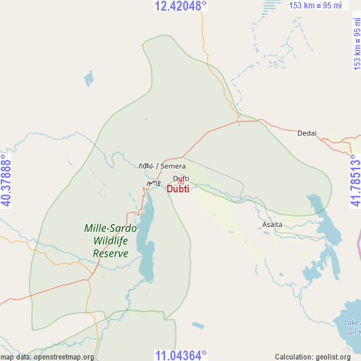
Dubti GPS coordinates[2]
11° 43' 58.512" North, 41° 4' 55.2" East
| Map corner | latitude | longitude |
|---|---|---|
| Upper-left | 12.42048°, | 40.37888° |
| Center: | 11.73292°, | 41.082° |
| Lower-right: | 11.04364°, | 41.78513° |
| Map W x H: | 153.1×153.1 km | = 95.1×95.1mi |
| max Lat: | 14.277° ⇑14% North |
| Dubti: | 11.73292° |
| min Lat: | ⇓86% South 4.05° |
| min Long | Dubti | max Long |
| 34.53333° | 41.082° | 42.8° |
| W 94.4%⇐ | ⇒5.6% E |
Elevation
Elevation of Dubti is 381 m = 1250 ft, and this is 1514.6 m = 4969 ft below average elevation for this country.
| Max E: |
2854 m = 9364 ft | 98.1% |
| Avg. | 1895.6 m = 6219 ft | |
| Dubti | 381 m = 1250 ft | |
Min E: |
367 m = 1204 ft | 1.9% |
See also: Ethiopia elevation on elevation.city.
Geographical zone
Dubti is located in North Torrid zone (between Equator and Tropic of Cancer). Distance of this Northern Tropic circle is 1301.3 km =808.6 mi to North.| Distance of | km | miles | from Dubti |
|---|---|---|---|
| North Pole | 8702.5 | 5407.5 | to North |
| Arctic Circle | 6096.6 | 3788.3 | to North |
| Tropic Cancer | 1301.3 | 808.6 | to North |
| Equator | 1304.6 | 810.6 | to South |


Nearby cities:
15 places around Dubti: (largest is in red/bold)
• Abomsa
228.6 km =142 mi,  211°
211°
• Asaita
42.9 km =26.7 mi,  115°
115°
• Batī
130.8 km =81.3 mi,  242°
242°
• Debre Sīna
254.5 km =158.1 mi, 214°
• Desē
171.4 km =106.5 mi,  247°
247°
• Dire Dawa
252.9 km =157.1 mi,  160°
160°
• Gewanē
180.5 km =112.2 mi,  195°
195°
• Kemisē
173.9 km =108.1 mi,  229°
229°
• Kombolcha
162.9 km =101.2 mi, 243°
• Korem
190 km =118.1 mi,  296°
296°
• Lalībela
223.8 km =139.1 mi,  278°
278°
• Maych’ew
204.3 km =126.9 mi,  305°
305°
• Robīt
160.8 km =99.9 mi, 281°
• Semera
10.7 km =6.6 mi, 309°
• Were Īlu
219.8 km =136.6 mi, 234°
Sources, notices
• [Note1] Compared only with cities in Ethiopia existing in our database
• [Src1] Map data: © OpenStreetMap contributors (CC-BY-SA)
• [Src2] Other city data from geonames.org with taken over terms of usage.
• [Src3] Geographical zone / Annual Mean Temperature by Robert A. Rohde @ Wikipedia
