Jijiga geodata
Jijiga (Somali) is a seat of a first-order administrative division; located in Ethiopia in Africa/Addis_Ababa (GMT+3) time zone. With population of 56,821 people, there are 19 cities with bigger population in this country. Compared to other cities in Ethiopia, 61.7% of cities are located further ↓South; 100% of cities are located further ←West and 75.7% of cities have higher elevation than Jijiga. Note1


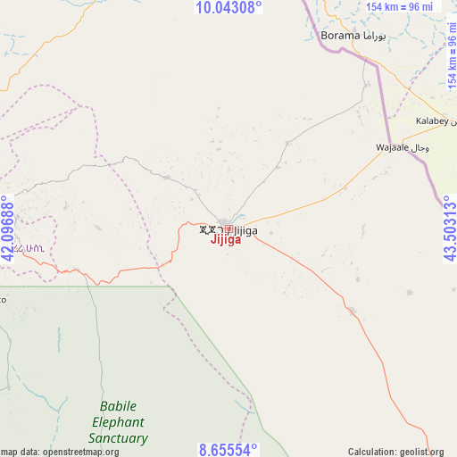
Jijiga GPS coordinates[2]
9° 21' 0" North, 42° 48' 0" East
| Map corner | latitude | longitude |
|---|---|---|
| Upper-left | 10.04308°, | 42.09688° |
| Center: | 9.35°, | 42.8° |
| Lower-right: | 8.65554°, | 43.50313° |
| Map W x H: | 154.3×154.3 km | = 95.9×95.9mi |
| max Lat: | 14.277° ⇑38.3% North |
| Jijiga: | 9.35° |
| min Lat: | ⇓61.7% South 4.05° |
| min Long | Jijiga | max Long |
| 34.53333° | 42.8° | 42.8° |
| W 100%⇐ | ⇒0% E |
Elevation
Elevation of Jijiga is 1646 m = 5400 ft, and this is 249.6 m = 819 ft below average elevation for this country.
| Max E: |
2854 m = 9364 ft | 75.7% |
| Avg. | 1895.6 m = 6219 ft | |
| Jijiga | 1646 m = 5400 ft | |
Min E: |
367 m = 1204 ft | 24.3% |
See also: Jijiga elevation on elevation.city.
Geographical zone
Jijiga is located in North Torrid zone (between Equator and Tropic of Cancer). Distance of Equator is 1039.6 km =646 mi to South.| Distance of | km | miles | from Jijiga |
|---|---|---|---|
| North Pole | 8967.4 | 5572.1 | to North |
| Arctic Circle | 6361.6 | 3952.9 | to North |
| Tropic Cancer | 1566.3 | 973.3 | to North |
| Equator | 1039.6 | 646 | to South |


Nearby cities:
15 places around Jijiga: (largest is in red/bold)
• Abomsa
316.7 km =196.8 mi,  282°
282°
• Asaita
288.1 km =179 mi,  328°
328°
• Bedēsa
227 km =141.1 mi,  257°
257°
• Deder
148.9 km =92.5 mi,  268°
268°
• Dire Dawa
105.9 km =65.8 mi, 284°
• Dubti
324.8 km =201.8 mi,  324°
324°
• Gelemso
257.6 km =160.1 mi, 256°
• Gewanē
252.8 km =157.1 mi,  291°
291°
• Ginir
336.5 km =209.1 mi,  223°
223°
• Harar
74.9 km =46.5 mi, 266°
• Hīrna
187.1 km =116.3 mi, 265°
• Metahāra
320.5 km =199.1 mi, 261°
• Semera
335.1 km =208.2 mi, 324°
• Āsbe Teferī
214.2 km =133.1 mi, 262°
• Āwash
291.9 km =181.4 mi, 261°
Sources, notices
• [Note1] Compared only with cities in Ethiopia existing in our database
• [Src1] Map data: © OpenStreetMap contributors (CC-BY-SA)
• [Src2] Other city data from geonames.org with taken over terms of usage.
• [Src3] Geographical zone / Annual Mean Temperature by Robert A. Rohde @ Wikipedia
