Bedēsa geodata
Bedēsa (Oromiya) is a populated place; located in Ethiopia in Africa/Addis_Ababa (GMT+3) time zone. With population of 17,526 people, there are 72 cities with bigger population in this country. Compared to other cities in Ethiopia, 52.3% of cities are located further ↑North; 91.6% of cities are located further ←West and 72% of cities have higher elevation than Bedēsa. Note1


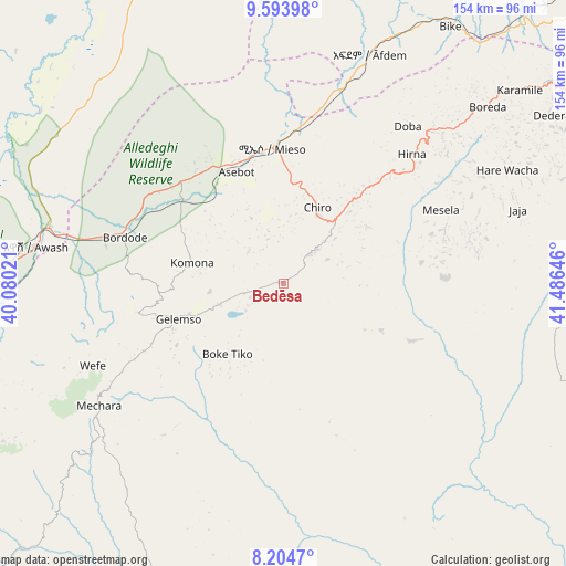
Bedēsa GPS coordinates[2]
8° 54' 0" North, 40° 46' 59.988" East
| Map corner | latitude | longitude |
|---|---|---|
| Upper-left | 9.59398°, | 40.08021° |
| Center: | 8.9°, | 40.78333° |
| Lower-right: | 8.2047°, | 41.48646° |
| Map W x H: | 154.5×154.5 km | = 96×96mi |
| max Lat: | 14.277° ⇑52.3% North |
| Bedēsa: | 8.9° |
| min Lat: | ⇓47.7% South 4.05° |
| min Long | Bedēsa | max Long |
| 34.53333° | 40.78333° | 42.8° |
| W 91.6%⇐ | ⇒8.4% E |
Elevation
Elevation of Bedēsa is 1683 m = 5522 ft, and this is 212.6 m = 698 ft below average elevation for this country.
| Max E: |
2854 m = 9364 ft | 72% |
| Avg. | 1895.6 m = 6219 ft | |
| Bedēsa | 1683 m = 5522 ft | |
Min E: |
367 m = 1204 ft | 28% |
See also: Ethiopia elevation on elevation.city.
Geographical zone
Bedēsa is located in North Torrid zone (between Equator and Tropic of Cancer). Distance of Equator is 989.6 km =614.9 mi to South.| Distance of | km | miles | from Bedēsa |
|---|---|---|---|
| North Pole | 9017.5 | 5603.2 | to North |
| Arctic Circle | 6411.6 | 3984 | to North |
| Tropic Cancer | 1616.3 | 1004.3 | to North |
| Equator | 989.6 | 614.9 | to South |


Nearby cities:
15 places around Bedēsa: (largest is in red/bold)
• Abomsa
149 km =92.6 mi,  323°
323°
• Debre Birhan
162.3 km =100.8 mi,  302°
302°
• Debre Sīna
153.9 km =95.6 mi,  313°
313°
• Deder
85.7 km =53.3 mi,  57°
57°
• Dire Dawa
141.6 km =88 mi, 57°
• Gelemso
30.7 km =19.1 mi,  252°
252°
• Gewanē
141.6 km =88 mi,  353°
353°
• Harar
153.6 km =95.4 mi,  72°
72°
• Hīrna
49.5 km =30.8 mi,  44°
44°
• Metahāra
95.2 km =59.2 mi,  270°
270°
• Nazrēt
171.2 km =106.4 mi,  256°
256°
• Sirre
156.9 km =97.5 mi, 245°
• Wenjī
172.3 km =107.1 mi, 253°
• Āsbe Teferī
22.6 km =14 mi,  24°
24°
• Āwash
68.4 km =42.5 mi,  277°
277°
Sources, notices
• [Note1] Compared only with cities in Ethiopia existing in our database
• [Src1] Map data: © OpenStreetMap contributors (CC-BY-SA)
• [Src2] Other city data from geonames.org with taken over terms of usage.
• [Src3] Geographical zone / Annual Mean Temperature by Robert A. Rohde @ Wikipedia
