Batī geodata
Batī (Amhara) is a populated place; located in Ethiopia in Africa/Addis_Ababa (GMT+3) time zone. With population of 19,260 people, there are 68 cities with bigger population in this country. Compared to other cities in Ethiopia, 82.2% of cities are located further ↓South; 86.9% of cities are located further ←West and 73.8% of cities have higher elevation than Batī. Note1


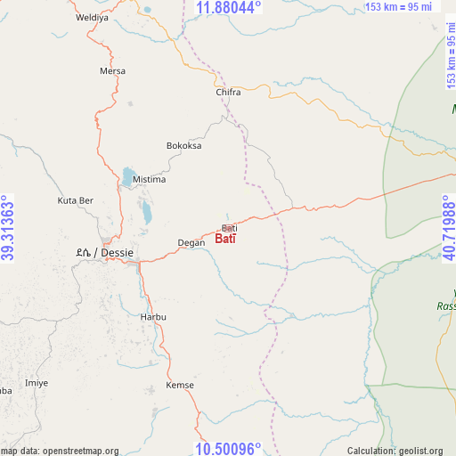
Batī GPS coordinates[2]
11° 11' 29.472" North, 40° 1' 0.3" East
| Map corner | latitude | longitude |
|---|---|---|
| Upper-left | 11.88044°, | 39.31363° |
| Center: | 11.19152°, | 40.01675° |
| Lower-right: | 10.50096°, | 40.71988° |
| Map W x H: | 153.4×153.4 km | = 95.3×95.3mi |
| max Lat: | 14.277° ⇑17.8% North |
| Batī: | 11.19152° |
| min Lat: | ⇓82.2% South 4.05° |
| min Long | Batī | max Long |
| 34.53333° | 40.01675° | 42.8° |
| W 86.9%⇐ | ⇒13.1% E |
Elevation
Elevation of Batī is 1662 m = 5453 ft, and this is 233.6 m = 766 ft below average elevation for this country.
| Max E: |
2854 m = 9364 ft | 73.8% |
| Avg. | 1895.6 m = 6219 ft | |
| Batī | 1662 m = 5453 ft | |
Min E: |
367 m = 1204 ft | 26.2% |
See also: Ethiopia elevation on elevation.city.
Geographical zone
Batī is located in North Torrid zone (between Equator and Tropic of Cancer). Distance of Equator is 1244.4 km =773.2 mi to South.| Distance of | km | miles | from Batī |
|---|---|---|---|
| North Pole | 8762.7 | 5444.9 | to North |
| Arctic Circle | 6156.8 | 3825.7 | to North |
| Tropic Cancer | 1361.5 | 846 | to North |
| Equator | 1244.4 | 773.2 | to South |


Nearby cities:
15 places around Batī: (largest is in red/bold)
• Abomsa
134.4 km =83.5 mi,  181°
181°
• Asaita
160.6 km =99.8 mi,  74°
74°
• Debre Birhan
176.3 km =109.5 mi,  197°
197°
• Debre Sīna
152 km =94.4 mi,  190°
190°
• Desē
42.3 km =26.3 mi,  261°
261°
• Dubti
130.8 km =81.3 mi,  62°
62°
• Gewanē
133.1 km =82.7 mi,  148°
148°
• Kemisē
55.2 km =34.3 mi, 196°
• Kombolcha
32.2 km =20 mi,  247°
247°
• Korem
155.7 km =96.7 mi,  339°
339°
• Lalībela
141 km =87.6 mi,  311°
311°
• Maych’ew
184.8 km =114.8 mi, 343°
• Robīt
100.8 km =62.6 mi, 335°
• Semera
126.9 km =78.9 mi, 58°
• Were Īlu
92.1 km =57.2 mi,  223°
223°
Sources, notices
• [Note1] Compared only with cities in Ethiopia existing in our database
• [Src1] Map data: © OpenStreetMap contributors (CC-BY-SA)
• [Src2] Other city data from geonames.org with taken over terms of usage.
• [Src3] Geographical zone / Annual Mean Temperature by Robert A. Rohde @ Wikipedia
