Desē geodata
Desē (Amhara) is a populated place; located in Ethiopia in Africa/Addis_Ababa (GMT+3) time zone. With population of 136,056 people, there are 6 cities with bigger population in this country. Compared to other cities in Ethiopia, 81.3% of cities are located further ↓South; 79.4% of cities are located further ←West and 85% of cities have lower elevation than Desē. Note1


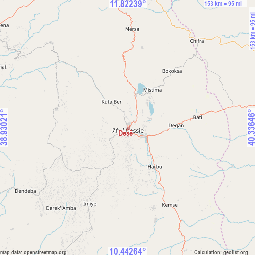
Desē GPS coordinates[2]
11° 7' 59.988" North, 39° 37' 59.988" East
| Map corner | latitude | longitude |
|---|---|---|
| Upper-left | 11.82239°, | 38.93021° |
| Center: | 11.13333°, | 39.63333° |
| Lower-right: | 10.44264°, | 40.33646° |
| Map W x H: | 153.4×153.4 km | = 95.3×95.3mi |
| max Lat: | 14.277° ⇑18.7% North |
| Desē: | 11.13333° |
| min Lat: | ⇓81.3% South 4.05° |
| min Long | Desē | max Long |
| 34.53333° | 39.63333° | 42.8° |
| W 79.4%⇐ | ⇒20.6% E |
Elevation
Elevation of Desē is 2494 m = 8182 ft, and this is 598.4 m = 1963 ft above average elevation for this country.
| Max E: |
2854 m = 9364 ft | 15% |
| Desē | 2494 m 8182 ft | |
| Avg. | 1895.6 m = 6219 ft | |
Min E: |
367 m = 1204 ft | 85% |
See also: Desē elevation on elevation.city.
Geographical zone
Desē is located in North Torrid zone (between Equator and Tropic of Cancer). Distance of Equator is 1237.9 km =769.2 mi to South.| Distance of | km | miles | from Desē |
|---|---|---|---|
| North Pole | 8769.2 | 5448.9 | to North |
| Arctic Circle | 6163.3 | 3829.7 | to North |
| Tropic Cancer | 1368 | 850 | to North |
| Equator | 1237.9 | 769.2 | to South |


Nearby cities:
15 places around Desē: (largest is in red/bold)
• Abomsa
133.5 km =83 mi,  163°
163°
• Batī
42.3 km =26.3 mi,  81°
81°
• Bichena
174 km =108.1 mi,  244°
244°
• Debre Birhan
162 km =100.7 mi,  183°
183°
• Debre Sīna
143.6 km =89.2 mi,  174°
174°
• Debre Werk’
168.3 km =104.6 mi,  252°
252°
• Dubti
171.4 km =106.5 mi,  67°
67°
• Gewanē
154.3 km =95.9 mi,  134°
134°
• Kemisē
53 km =32.9 mi,  150°
150°
• Kombolcha
13.3 km =8.3 mi,  115°
115°
• Korem
153.1 km =95.1 mi,  355°
355°
• Lalībela
118.6 km =73.7 mi,  327°
327°
• Robīt
98.2 km =61 mi,  0°
0°
• Semera
166.6 km =103.5 mi,  63°
63°
• Were Īlu
64.1 km =39.8 mi,  199°
199°
Sources, notices
• [Note1] Compared only with cities in Ethiopia existing in our database
• [Src1] Map data: © OpenStreetMap contributors (CC-BY-SA)
• [Src2] Other city data from geonames.org with taken over terms of usage.
• [Src3] Geographical zone / Annual Mean Temperature by Robert A. Rohde @ Wikipedia
