Fāmenīn geodata
Fāmenīn (Hamadān) is a seat of a second-order administrative division; located in Iran in Asia/Tehran (GMT+3.5) time zone. In our database, there are 232 cities with bigger population. Compared to other cities in Iran, 57.1% of cities are located further ↓South; 71.9% of cities are located further →East and 79.4% of cities have lower elevation than Fāmenīn. Note1


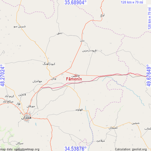
Fāmenīn GPS coordinates[2]
35° 6' 57.348" North, 48° 58' 24.096" East
| Map corner | latitude | longitude |
|---|---|---|
| Upper-left | 35.68904°, | 48.27024° |
| Center: | 35.11593°, | 48.97336° |
| Lower-right: | 34.53876°, | 49.67649° |
| Map W x H: | 127.9×127.9 km | = 79.5×79.5mi |
| max Lat: | 39.6482° ⇑42.9% North |
| Fāmenīn: | 35.11593° |
| min Lat: | ⇓57.1% South 25.2919° |
| min Long | Fāmenīn | max Long |
| 44.38416° | 48.97336° | 61.9965° |
| W 28.1%⇐ | ⇒71.9% E |
Elevation
Elevation of Fāmenīn is 1637 m = 5371 ft, and this is 588 m = 1929 ft above average elevation for this country.
| Max E: |
2564 m = 8412 ft | 20.6% |
| Fāmenīn | 1637 m 5371 ft | |
| Avg. | 1049 m = 3442 ft | |
Min E: |
-24 m = -79 ft | 79.4% |
See also: Iran elevation on elevation.city.
Geographical zone
Fāmenīn is located in North temperate zone (between Tropic of Cancer and the Arctic Circle). Distance of this Northern Tropic circle is 1298.6 km =806.9 mi to South.| Distance of | km | miles | from Fāmenīn |
|---|---|---|---|
| North Pole | 6102.5 | 3791.9 | to North |
| Arctic Circle | 3496.6 | 2172.7 | to North |
| Tropic Cancer | 1298.6 | 806.9 | to South |
| Equator | 3904.5 | 2426.1 | to South |


Nearby cities:
15 places around Fāmenīn: (largest is in red/bold)
• Asadābād
86.2 km =53.6 mi,  244°
244°
• Bahār
53.7 km =33.4 mi, 244°
• Farmahīn
94 km =58.4 mi,  136°
136°
• Hamadān
54.7 km =34 mi,  229°
229°
• Kabūdarāhang
25 km =15.5 mi,  294°
294°
• Khondāb
82.7 km =51.4 mi,  166°
166°
• Komījān
54.4 km =33.8 mi, 143°
• Malāyer
91.6 km =56.9 mi,  188°
188°
• Pasragad Branch
59.2 km =36.8 mi, 230°
• Qohūrd-e ‘Olyā
89.3 km =55.5 mi, 293°
• Qorveh
106.3 km =66.1 mi,  273°
273°
• Razan
30.5 km =19 mi,  10°
10°
• Tafresh
106.1 km =65.9 mi,  116°
116°
• Tūyserkān
79.3 km =49.3 mi,  217°
217°
• Āzādshahr
51.6 km =32.1 mi, 225°
Sources, notices
• [Note1] Compared only with cities in Iran existing in our database
• [Src1] Map data: © OpenStreetMap contributors (CC-BY-SA)
• [Src2] Other city data from geonames.org with taken over terms of usage.
• [Src3] Geographical zone / Annual Mean Temperature by Robert A. Rohde @ Wikipedia
