Kabūdarāhang geodata
Kabūdarāhang (Hamadān) is a seat of a second-order administrative division; located in Iran in Asia/Tehran (GMT+3.5) time zone. In our database, there are 232 cities with bigger population. Compared to other cities in Iran, 57.6% of cities are located further ↓South; 74.1% of cities are located further →East and 81% of cities have lower elevation than Kabūdarāhang. Note1


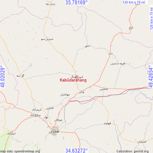
Kabūdarāhang GPS coordinates[2]
35° 12' 33.264" North, 48° 43' 24.276" East
| Map corner | latitude | longitude |
|---|---|---|
| Upper-left | 35.78169°, | 48.02029° |
| Center: | 35.20924°, | 48.72341° |
| Lower-right: | 34.63272°, | 49.42654° |
| Map W x H: | 127.8×127.8 km | = 79.4×79.4mi |
| max Lat: | 39.6482° ⇑42.4% North |
| Kabūdarāhang: | 35.20924° |
| min Lat: | ⇓57.6% South 25.2919° |
| min Long | Kabūdarāhang | max Long |
| 44.38416° | 48.72341° | 61.9965° |
| W 25.9%⇐ | ⇒74.1% E |
Elevation
Elevation of Kabūdarāhang is 1670 m = 5479 ft, and this is 621 m = 2037 ft above average elevation for this country.
| Max E: |
2564 m = 8412 ft | 19% |
| Kabūdarāhang | 1670 m 5479 ft | |
| Avg. | 1049 m = 3442 ft | |
Min E: |
-24 m = -79 ft | 81% |
See also: Iran elevation on elevation.city.
Geographical zone
Kabūdarāhang is located in North temperate zone (between Tropic of Cancer and the Arctic Circle). Distance of this Northern Tropic circle is 1309 km =813.4 mi to South.| Distance of | km | miles | from Kabūdarāhang |
|---|---|---|---|
| North Pole | 6092.2 | 3785.5 | to North |
| Arctic Circle | 3486.3 | 2166.3 | to North |
| Tropic Cancer | 1309 | 813.4 | to South |
| Equator | 3914.9 | 2432.6 | to South |


Nearby cities:
15 places around Kabūdarāhang: (largest is in red/bold)
• Asadābād
72.6 km =45.1 mi,  229°
229°
• Bahār
42.3 km =26.3 mi,  217°
217°
• Fāmenīn
25 km =15.5 mi,  114°
114°
• Hamadān
49.4 km =30.7 mi,  202°
202°
• Kangāvar
104.5 km =64.9 mi, 221°
• Khondāb
100.1 km =62.2 mi,  155°
155°
• Komījān
77.2 km =48 mi,  134°
134°
• Malāyer
101.3 km =62.9 mi,  174°
174°
• Pasragad Branch
53.2 km =33.1 mi,  205°
205°
• Qohūrd-e ‘Olyā
64.3 km =40 mi,  293°
293°
• Qorveh
83.5 km =51.9 mi,  266°
266°
• Razan
34.3 km =21.3 mi,  55°
55°
• Sonqor
112.9 km =70.2 mi,  245°
245°
• Tūyserkān
77.5 km =48.2 mi, 199°
• Āzādshahr
48.6 km =30.2 mi, 196°
Sources, notices
• [Note1] Compared only with cities in Iran existing in our database
• [Src1] Map data: © OpenStreetMap contributors (CC-BY-SA)
• [Src2] Other city data from geonames.org with taken over terms of usage.
• [Src3] Geographical zone / Annual Mean Temperature by Robert A. Rohde @ Wikipedia
