Burlin geodata
Burlin (Batys Qazaqstan) is a populated place; located in Kazakhstan in Asia/Oral (GMT+5) time zone. With population of 3,593 people, there are 221 cities with bigger population in this country. Compared to other cities in Kazakhstan, 77.8% of cities are located further ↓South; 90% of cities are located further →East and 89.3% of cities have higher elevation than Burlin. Note1


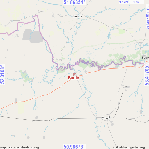
Burlin GPS coordinates[2]
51° 25' 38.064" North, 52° 42' 50.112" East
| Map corner | latitude | longitude |
|---|---|---|
| Upper-left | 51.86354°, | 52.0108° |
| Center: | 51.42724°, | 52.71392° |
| Lower-right: | 50.98673°, | 53.41705° |
| Map W x H: | 97.5×97.5 km | = 60.6×60.6mi |
| max Lat: | 54.90596° ⇑22.2% North |
| Burlin: | 51.42724° |
| min Lat: | ⇓77.8% South 40.66338° |
| min Long | Burlin | max Long |
| 46.83361° | 52.71392° | 84.87144° |
| W 10%⇐ | ⇒90% E |
Elevation
Elevation of Burlin is 50 m = 164 ft, and this is 306.5 m = 1006 ft below average elevation for this country.
| Max E: |
1847 m = 6060 ft | 89.3% |
| Avg. | 356.5 m = 1170 ft | |
| Burlin | 50 m = 164 ft | |
Min E: |
-26 m = -85 ft | 10.7% |
See also: Kazakhstan elevation on elevation.city.
Geographical zone
Burlin is located in North temperate zone (between Tropic of Cancer and the Arctic Circle). Distance of this North polar circle is 1683 km =1045.8 mi to North.| Distance of | km | miles | from Burlin |
|---|---|---|---|
| North Pole | 4288.9 | 2665 | to North |
| Arctic Circle | 1683 | 1045.8 | to North |
| Tropic Cancer | 3112.3 | 1933.9 | to South |
| Equator | 5718.2 | 3553.1 | to South |


Nearby cities:
15 places around Burlin: (largest is in red/bold)
• Akkol’
297.2 km =184.7 mi,  173°
173°
• Aqsay
34.9 km =21.7 mi,  145°
145°
• Chapaev
174.5 km =108.4 mi,  218°
218°
• Chingirlau
102.1 km =63.4 mi,  110°
110°
• Dzhambeyty
130.4 km =81 mi,  183°
183°
• Dzhangala
298.3 km =185.4 mi,  214°
214°
• Fedorovka
57.4 km =35.7 mi,  246°
246°
• Inderbor
326.8 km =203.1 mi,  191°
191°
• Krūgloozernoe
106.4 km =66.1 mi, 248°
• Martuk
275.4 km =171.1 mi, 105°
• Miyaly
292.9 km =182 mi,  164°
164°
• Oral
96 km =59.7 mi,  257°
257°
• Peremetnoe
131.6 km =81.8 mi, 258°
• Tasqala
171.9 km =106.8 mi, 258°
• Zhumysker
330.7 km =205.5 mi,  225°
225°
Sources, notices
• [Note1] Compared only with cities in Kazakhstan existing in our database
• [Src1] Map data: © OpenStreetMap contributors (CC-BY-SA)
• [Src2] Other city data from geonames.org with taken over terms of usage.
• [Src3] Geographical zone / Annual Mean Temperature by Robert A. Rohde @ Wikipedia
