Saryozek geodata
Saryozek (Almaty Oblysy) is a populated place; located in Kazakhstan in Asia/Almaty (GMT+5) time zone. With population of 13,930 people, there are 84 cities with bigger population in this country. Compared to other cities in Kazakhstan, 77% of cities are located further ↑North; 83% of cities are located further ←West and 96.7% of cities have lower elevation than Saryozek. Note1


Saryozek GPS coordinates[2]
44° 21' 42.408" North, 77° 58' 22.044" East
| Map corner | latitude | longitude |
|---|---|---|
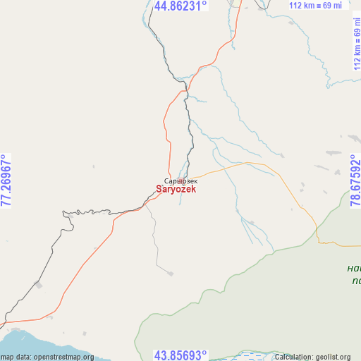
| Upper-left | 44.86231°, | 77.26967° |
| Center: | 44.36178°, | 77.97279° |
| Lower-right: | 43.85693°, | 78.67592° |
| Map W x H: | 111.8×111.8 km | = 69.5×69.5mi |
| max Lat: | 54.90596° ⇑77% North |
| Saryozek: | 44.36178° |
| min Lat: | ⇓23% South 40.66338° |
| min Long | Saryozek | max Long |
| 46.83361° | 77.97279° | 84.87144° |
| W 83%⇐ | ⇒17% E |
Elevation
Elevation of Saryozek is 932 m = 3058 ft, and this is 575.5 m = 1888 ft above average elevation for this country.
| Max E: |
1847 m = 6060 ft | 3.3% |
| Saryozek | 932 m 3058 ft | |
| Avg. | 356.5 m = 1170 ft | |
Min E: |
-26 m = -85 ft | 96.7% |
See also: Kazakhstan elevation on elevation.city.
Geographical zone
Saryozek is located in North temperate zone (between Tropic of Cancer and the Arctic Circle). Distance of this Northern Tropic circle is 2326.6 km =1445.7 mi to South.| Distance of | km | miles | from Saryozek |
|---|---|---|---|
| North Pole | 5074.5 | 3153.1 | to North |
| Arctic Circle | 2468.6 | 1533.9 | to North |
| Tropic Cancer | 2326.6 | 1445.7 | to South |
| Equator | 4932.6 | 3065 | to South |


Nearby cities:
15 places around Saryozek: (largest is in red/bold)
• Almaty
148.7 km =92.4 mi,  214°
214°
• Bakanas
143.5 km =89.2 mi,  290°
290°
• Balpyk Bī
63.5 km =39.5 mi,  18°
18°
• Burunday
143.3 km =89 mi,  218°
218°
• Chemolgan
153.9 km =95.6 mi, 224°
• Esik
119.4 km =74.2 mi,  200°
200°
• Kapshagay
91.1 km =56.6 mi,  232°
232°
• Molaly
124.3 km =77.2 mi,  12°
12°
• Otegen Batyra
129.6 km =80.5 mi, 216°
• Pervomayka
137.6 km =85.5 mi, 216°
• Taldykorgan
79.3 km =49.3 mi, 23°
• Talghar
131.5 km =81.7 mi, 206°
• Tekeli
85.8 km =53.3 mi,  52°
52°
• Turgen
111.1 km =69 mi, 195°
• Ush-Tyube
99 km =61.5 mi,  0°
0°
Sources, notices
• [Note1] Compared only with cities in Kazakhstan existing in our database
• [Src1] Map data: © OpenStreetMap contributors (CC-BY-SA)
• [Src2] Other city data from geonames.org with taken over terms of usage.
• [Src3] Geographical zone / Annual Mean Temperature by Robert A. Rohde @ Wikipedia
