Esik geodata
Esik (Almaty Oblysy) is a populated place; located in Kazakhstan in Asia/Almaty (GMT+5) time zone. With population of 32,995 people, there are 51 cities with bigger population in this country. Compared to other cities in Kazakhstan, 86.7% of cities are located further ↑North; 81.9% of cities are located further ←West and 98.1% of cities have lower elevation than Esik. Note1


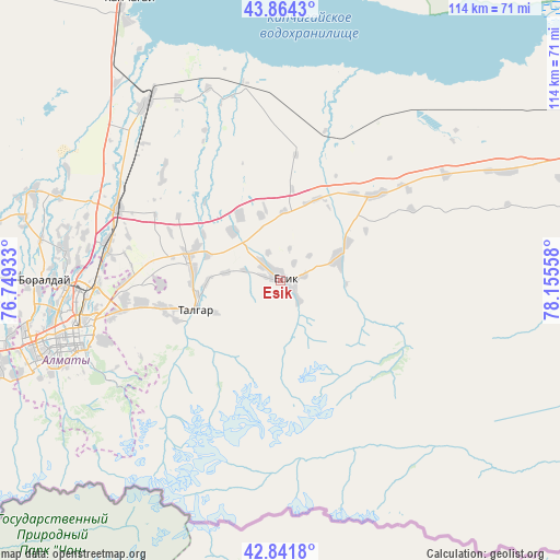
Esik GPS coordinates[2]
43° 21' 18.72" North, 77° 27' 8.82" East
| Map corner | latitude | longitude |
|---|---|---|
| Upper-left | 43.8643°, | 76.74933° |
| Center: | 43.3552°, | 77.45245° |
| Lower-right: | 42.8418°, | 78.15558° |
| Map W x H: | 113.7×113.7 km | = 70.6×70.6mi |
| max Lat: | 54.90596° ⇑86.7% North |
| Esik: | 43.3552° |
| min Lat: | ⇓13.3% South 40.66338° |
| min Long | Esik | max Long |
| 46.83361° | 77.45245° | 84.87144° |
| W 81.9%⇐ | ⇒18.1% E |
Elevation
Elevation of Esik is 1029 m = 3376 ft, and this is 672.5 m = 2206 ft above average elevation for this country.
| Max E: |
1847 m = 6060 ft | 1.9% |
| Esik | 1029 m 3376 ft | |
| Avg. | 356.5 m = 1170 ft | |
Min E: |
-26 m = -85 ft | 98.1% |
See also: Kazakhstan elevation on elevation.city.
Geographical zone
Esik is located in North temperate zone (between Tropic of Cancer and the Arctic Circle). Distance of this Northern Tropic circle is 2214.7 km =1376.2 mi to South.| Distance of | km | miles | from Esik |
|---|---|---|---|
| North Pole | 5186.4 | 3222.7 | to North |
| Arctic Circle | 2580.5 | 1603.4 | to North |
| Tropic Cancer | 2214.7 | 1376.2 | to South |
| Equator | 4820.6 | 2995.4 | to South |


Nearby cities:
15 places around Esik: (largest is in red/bold)
• Almaty
43.8 km =27.2 mi,  255°
255°
• Bakanas
187.1 km =116.3 mi,  329°
329°
• Balpyk Bī
182.9 km =113.6 mi,  19°
19°
• Burunday
48.3 km =30 mi,  270°
270°
• Chemolgan
67 km =41.6 mi, 272°
• Kapshagay
65 km =40.4 mi, 331°
• Kegen
148.1 km =92 mi,  104°
104°
• Otegen Batyra
35.7 km =22.2 mi,  281°
281°
• Pervomayka
41.5 km =25.8 mi, 272°
• Saryozek
119.4 km =74.2 mi, 20°
• Taldykorgan
198.7 km =123.5 mi, 21°
• Talghar
18.1 km =11.2 mi,  251°
251°
• Tekeli
197.8 km =122.9 mi,  33°
33°
• Turgen
12.5 km =7.8 mi,  66°
66°
• Ush-Tyube
215 km =133.6 mi,  11°
11°
Sources, notices
• [Note1] Compared only with cities in Kazakhstan existing in our database
• [Src1] Map data: © OpenStreetMap contributors (CC-BY-SA)
• [Src2] Other city data from geonames.org with taken over terms of usage.
• [Src3] Geographical zone / Annual Mean Temperature by Robert A. Rohde @ Wikipedia
