Chemolgan geodata
Chemolgan (Almaty Oblysy) is a populated place; located in Kazakhstan in Asia/Almaty (GMT+5) time zone. With population of 13,616 people, there are 87 cities with bigger population in this country. Compared to other cities in Kazakhstan, 85.6% of cities are located further ↑North; 77.8% of cities are located further ←West and 88.9% of cities have lower elevation than Chemolgan. Note1


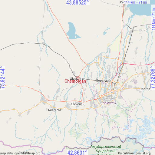
Chemolgan GPS coordinates[2]
43° 22' 34.788" North, 76° 37' 28.416" East
| Map corner | latitude | longitude |
|---|---|---|
| Upper-left | 43.88525°, | 75.92144° |
| Center: | 43.37633°, | 76.62456° |
| Lower-right: | 42.8631°, | 77.32769° |
| Map W x H: | 113.7×113.7 km | = 70.6×70.6mi |
| max Lat: | 54.90596° ⇑85.6% North |
| Chemolgan: | 43.37633° |
| min Lat: | ⇓14.4% South 40.66338° |
| min Long | Chemolgan | max Long |
| 46.83361° | 76.62456° | 84.87144° |
| W 77.8%⇐ | ⇒22.2% E |
Elevation
Elevation of Chemolgan is 687 m = 2254 ft, and this is 330.5 m = 1084 ft above average elevation for this country.
| Max E: |
1847 m = 6060 ft | 11.1% |
| Chemolgan | 687 m 2254 ft | |
| Avg. | 356.5 m = 1170 ft | |
Min E: |
-26 m = -85 ft | 88.9% |
See also: Kazakhstan elevation on elevation.city.
Geographical zone
Chemolgan is located in North temperate zone (between Tropic of Cancer and the Arctic Circle). Distance of this Northern Tropic circle is 2217.1 km =1377.6 mi to South.| Distance of | km | miles | from Chemolgan |
|---|---|---|---|
| North Pole | 5184.1 | 3221.2 | to North |
| Arctic Circle | 2578.2 | 1602 | to North |
| Tropic Cancer | 2217.1 | 1377.6 | to South |
| Equator | 4823 | 2996.9 | to South |


Nearby cities:
15 places around Chemolgan: (largest is in red/bold)
• Almaty
28 km =17.4 mi,  118°
118°
• Bakanas
161.7 km =100.5 mi,  349°
349°
• Balpyk Bī
212.7 km =132.2 mi,  37°
37°
• Burunday
18.7 km =11.6 mi,  97°
97°
• Chu
232.5 km =144.5 mi,  276°
276°
• Esik
67 km =41.6 mi,  92°
92°
• Georgiyevka
159.4 km =99 mi,  256°
256°
• Kapshagay
65 km =40.4 mi,  32°
32°
• Kegen
214.1 km =133 mi, 100°
• Otegen Batyra
32.3 km =20.1 mi,  81°
81°
• Pervomayka
25.5 km =15.8 mi, 90°
• Saryozek
153.9 km =95.6 mi, 44°
• Taldykorgan
229.5 km =142.6 mi, 37°
• Talghar
50.5 km =31.4 mi, 99°
• Turgen
78.3 km =48.7 mi, 88°
Sources, notices
• [Note1] Compared only with cities in Kazakhstan existing in our database
• [Src1] Map data: © OpenStreetMap contributors (CC-BY-SA)
• [Src2] Other city data from geonames.org with taken over terms of usage.
• [Src3] Geographical zone / Annual Mean Temperature by Robert A. Rohde @ Wikipedia
