Mynaral geodata
Mynaral (Zhambyl) is a populated place; located in Kazakhstan in Asia/Almaty (GMT+5) time zone. With population of 1,303 people, there are 259 cities with bigger population in this country. Compared to other cities in Kazakhstan, 70% of cities are located further ↑North; 69.6% of cities are located further ←West and 52.6% of cities have lower elevation than Mynaral. Note1


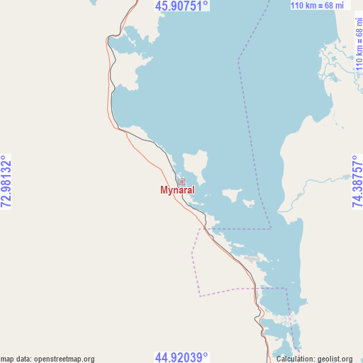
Mynaral GPS coordinates[2]
45° 24' 57.996" North, 73° 41' 3.984" East
| Map corner | latitude | longitude |
|---|---|---|
| Upper-left | 45.90751°, | 72.98132° |
| Center: | 45.41611°, | 73.68444° |
| Lower-right: | 44.92039°, | 74.38757° |
| Map W x H: | 109.8×109.8 km | = 68.2×68.2mi |
| max Lat: | 54.90596° ⇑70% North |
| Mynaral: | 45.41611° |
| min Lat: | ⇓30% South 40.66338° |
| min Long | Mynaral | max Long |
| 46.83361° | 73.68444° | 84.87144° |
| W 69.6%⇐ | ⇒30.4% E |
Elevation
Elevation of Mynaral is 347 m = 1138 ft, and this is 9.5 m = 31 ft below average elevation for this country.
| Max E: |
1847 m = 6060 ft | 47.4% |
| Avg. | 356.5 m = 1170 ft | |
| Mynaral | 347 m = 1138 ft | |
Min E: |
-26 m = -85 ft | 52.6% |
See also: Kazakhstan elevation on elevation.city.
Geographical zone
Mynaral is located in North temperate zone (between Tropic of Cancer and the Arctic Circle). Distance of this North polar circle is 2351.4 km =1461.1 mi to North.| Distance of | km | miles | from Mynaral |
|---|---|---|---|
| North Pole | 4957.3 | 3080.3 | to North |
| Arctic Circle | 2351.4 | 1461.1 | to North |
| Tropic Cancer | 2443.9 | 1518.6 | to South |
| Equator | 5049.8 | 3137.8 | to South |


Nearby cities:
15 places around Mynaral: (largest is in red/bold)
• Aqbaqay
84.4 km =52.4 mi,  236°
236°
• Bakanas
214 km =133 mi,  108°
108°
• Balqash
188.5 km =117.1 mi,  32°
32°
• Chu
201.6 km =125.3 mi,  178°
178°
• Georgiyevka
276.7 km =171.9 mi,  162°
162°
• Gülshat
144.6 km =89.9 mi,  21°
21°
• Karabas
230.7 km =143.4 mi,  57°
57°
• Khantaū
132.5 km =82.3 mi, 176°
• Moyynkum
138.8 km =86.2 mi,  205°
205°
• Moyynty
202.2 km =125.6 mi,  353°
353°
• Priozersk
68.4 km =42.5 mi,  1°
1°
• Saryshaghan
78.3 km =48.7 mi,  356°
356°
• Shashūbay
187.6 km =116.6 mi, 33°
• Zhambyl
265.5 km =165 mi,  318°
318°
• Ülken
32.3 km =20.1 mi,  134°
134°
Sources, notices
• [Note1] Compared only with cities in Kazakhstan existing in our database
• [Src1] Map data: © OpenStreetMap contributors (CC-BY-SA)
• [Src2] Other city data from geonames.org with taken over terms of usage.
• [Src3] Geographical zone / Annual Mean Temperature by Robert A. Rohde @ Wikipedia
