Pervomayka geodata
Pervomayka (Almaty Oblysy) is a populated place; located in Kazakhstan in Asia/Almaty (GMT+5) time zone. With population of 7,874 people, there are 145 cities with bigger population in this country. Compared to other cities in Kazakhstan, 85.9% of cities are located further ↑North; 79.6% of cities are located further ←West and 87.8% of cities have lower elevation than Pervomayka. Note1


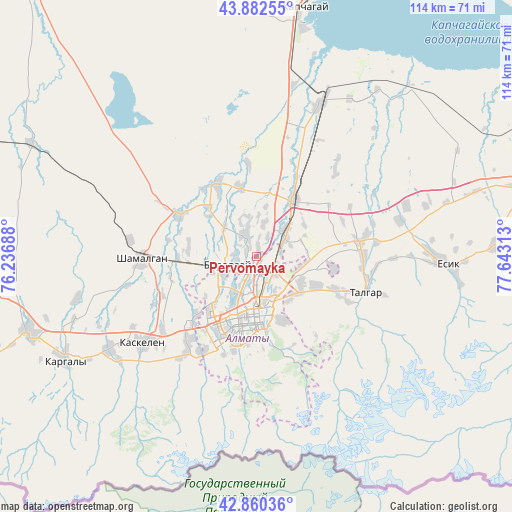
Pervomayka GPS coordinates[2]
43° 22' 24.996" North, 76° 56' 24" East
| Map corner | latitude | longitude |
|---|---|---|
| Upper-left | 43.88255°, | 76.23688° |
| Center: | 43.37361°, | 76.94° |
| Lower-right: | 42.86036°, | 77.64313° |
| Map W x H: | 113.7×113.7 km | = 70.6×70.6mi |
| max Lat: | 54.90596° ⇑85.9% North |
| Pervomayka: | 43.37361° |
| min Lat: | ⇓14.1% South 40.66338° |
| min Long | Pervomayka | max Long |
| 46.83361° | 76.94° | 84.87144° |
| W 79.6%⇐ | ⇒20.4% E |
Elevation
Elevation of Pervomayka is 670 m = 2198 ft, and this is 313.5 m = 1029 ft above average elevation for this country.
| Max E: |
1847 m = 6060 ft | 12.2% |
| Pervomayka | 670 m 2198 ft | |
| Avg. | 356.5 m = 1170 ft | |
Min E: |
-26 m = -85 ft | 87.8% |
See also: Kazakhstan elevation on elevation.city.
Geographical zone
Pervomayka is located in North temperate zone (between Tropic of Cancer and the Arctic Circle). Distance of this Northern Tropic circle is 2216.8 km =1377.5 mi to South.| Distance of | km | miles | from Pervomayka |
|---|---|---|---|
| North Pole | 5184.4 | 3221.4 | to North |
| Arctic Circle | 2578.5 | 1602.2 | to North |
| Tropic Cancer | 2216.8 | 1377.5 | to South |
| Equator | 4822.7 | 2996.7 | to South |


Nearby cities:
15 places around Pervomayka: (largest is in red/bold)
• Almaty
13 km =8.1 mi,  184°
184°
• Bakanas
168.2 km =104.5 mi,  341°
341°
• Balpyk Bī
198.8 km =123.5 mi,  31°
31°
• Burunday
7.2 km =4.5 mi,  253°
253°
• Chemolgan
25.5 km =15.8 mi,  270°
270°
• Esik
41.5 km =25.8 mi,  92°
92°
• Georgiyevka
184.3 km =114.5 mi,  258°
258°
• Kapshagay
55.7 km =34.6 mi,  10°
10°
• Kegen
189 km =117.4 mi,  101°
101°
• Otegen Batyra
8.2 km =5.1 mi,  51°
51°
• Saryozek
137.6 km =85.5 mi,  36°
36°
• Taldykorgan
215.4 km =133.8 mi, 32°
• Talghar
25.5 km =15.8 mi,  107°
107°
• Tekeli
221.6 km =137.7 mi, 42°
• Turgen
52.9 km =32.9 mi, 86°
Sources, notices
• [Note1] Compared only with cities in Kazakhstan existing in our database
• [Src1] Map data: © OpenStreetMap contributors (CC-BY-SA)
• [Src2] Other city data from geonames.org with taken over terms of usage.
• [Src3] Geographical zone / Annual Mean Temperature by Robert A. Rohde @ Wikipedia
