Garbahaarrey geodata
Garbahaarrey (Gedo) is a seat of a first-order administrative division; located in Somalia in Africa/Mogadishu (GMT+3) time zone. With population of 12,652 people, there are 28 cities with bigger population in this country. Compared to other cities in Somalia, 66% of cities are located further ↑North; 98.1% of cities are located further →East and 62.3% of cities have lower elevation than Garbahaarrey. Note1


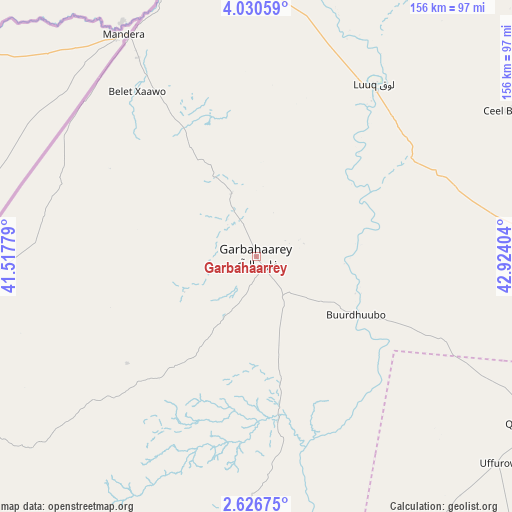
Garbahaarrey GPS coordinates[2]
3° 19' 44.112" North, 42° 13' 15.276" East
| Map corner | latitude | longitude |
|---|---|---|
| Upper-left | 4.03059°, | 41.51779° |
| Center: | 3.32892°, | 42.22091° |
| Lower-right: | 2.62675°, | 42.92404° |
| Map W x H: | 156.1×156.1 km | = 97×97mi |
| max Lat: | 11.96611° ⇑66% North |
| Garbahaarrey: | 3.32892° |
| min Lat: | ⇓34% South -1.21917° |
| min Long | Garbahaarrey | max Long |
| 41.83725° | 42.22091° | 51.0773° |
| W 1.9%⇐ | ⇒98.1% E |
Elevation
Elevation of Garbahaarrey is 222 m = 728 ft, and this is 67.9 m = 223 ft below average elevation for this country.
| Max E: |
1786 m = 5860 ft | 37.7% |
| Avg. | 289.9 m = 951 ft | |
| Garbahaarrey | 222 m = 728 ft | |
Min E: |
-2 m = -7 ft | 62.3% |
See also: Somalia elevation on elevation.city.
Geographical zone
Garbahaarrey is located in North Torrid zone (between Equator and Tropic of Cancer). Distance of Equator is 370.1 km =230 mi to South.| Distance of | km | miles | from Garbahaarrey |
|---|---|---|---|
| North Pole | 9636.9 | 5988.1 | to North |
| Arctic Circle | 7031 | 4368.9 | to North |
| Tropic Cancer | 2235.8 | 1389.3 | to North |
| Equator | 370.1 | 230 | to South |


Nearby cities:
15 places around Garbahaarrey: (largest is in red/bold)
• Baardheere
109.6 km =68.1 mi,  176°
176°
• Baidoa
160.4 km =99.7 mi,  98°
98°
• Buurhakaba
214.3 km =133.2 mi,  105°
105°
• Bu’aale
252.9 km =157.1 mi,  170°
170°
• Dujuuma
234.1 km =145.5 mi, 170°
• Jilib
322 km =200.1 mi, 168°
• Luuq
63.8 km =39.6 mi,  34°
34°
• Marka
335.3 km =208.3 mi,  122°
122°
• Qoryooley
308.5 km =191.7 mi, 123°
• Saacow
190.7 km =118.5 mi, 172°
• Tayeeglow
265.5 km =165 mi,  73°
73°
• Waajid
125.7 km =78.1 mi,  64°
64°
• Wanlaweyn
307.1 km =190.8 mi, 104°
• Xuddur
205 km =127.4 mi, 64°
• Yeed
163 km =101.3 mi, 33°
Sources, notices
• [Note1] Compared only with cities in Somalia existing in our database
• [Src1] Map data: © OpenStreetMap contributors (CC-BY-SA)
• [Src2] Other city data from geonames.org with taken over terms of usage.
• [Src3] Geographical zone / Annual Mean Temperature by Robert A. Rohde @ Wikipedia
