Sinazongwe geodata
Sinazongwe (Southern) is a populated place; located in Zambia in Africa/Lusaka (GMT+2) time zone. With population of 11,528 people, there are 37 cities with bigger population in this country. Compared to other cities in Zambia, 95.5% of cities are located further ↑North; 69.7% of cities are located further →East and 98.5% of cities have higher elevation than Sinazongwe. Note1


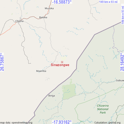
Sinazongwe GPS coordinates[2]
17° 15' 41.04" South, 27° 27' 42.444" East
| Map corner | latitude | longitude |
|---|---|---|
| Upper-left | -16.58873°, | 26.75867° |
| Center: | -17.2614°, | 27.46179° |
| Lower-right: | -17.93162°, | 28.16492° |
| Map W x H: | 149.3×149.3 km | = 92.8×92.8mi |
| max Lat: | -8.46887° ⇑95.5% North |
| Sinazongwe: | -17.2614° |
| min Lat: | ⇓4.5% South -17.84194° |
| min Long | Sinazongwe | max Long |
| 22.67926° | 27.46179° | 33.1782° |
| W 30.3%⇐ | ⇒69.7% E |
Elevation
Elevation of Sinazongwe is 504 m = 1654 ft, and this is 639.4 m = 2098 ft below average elevation for this country.
| Max E: |
1622 m = 5322 ft | 98.5% |
| Avg. | 1143.4 m = 3751 ft | |
| Sinazongwe | 504 m = 1654 ft | |
Min E: |
328 m = 1076 ft | 1.5% |
See also: Zambia elevation on elevation.city.
Geographical zone
Sinazongwe is located in South Torrid zone (between Equator and Tropic of Capricorn). Distance of this Southern Tropic circle is 686.6 km =426.6 mi to South.| Distance of | km | miles | from Sinazongwe |
|---|---|---|---|
| Equator | 1919.3 | 1192.6 | to North |
| Tropic Capricorn | 686.6 | 426.6 | to South |
| Antarctic Circle | 5481.9 | 3406.3 | to South |
| South Pole | 8087.8 | 5025.5 | to South |


Nearby cities:
15 places around Sinazongwe: (largest is in red/bold)
• Chibombo
296.8 km =184.4 mi,  12°
12°
• Choma
71.2 km =44.2 mi,  314°
314°
• Chongwe
251.2 km =156.1 mi,  31°
31°
• Gwembe
86.3 km =53.6 mi, 10°
• Kabwe
330.2 km =205.2 mi,  18°
18°
• Kafue
182.8 km =113.6 mi, 24°
• Livingstone
182.2 km =113.2 mi,  249°
249°
• Lusaka
224.2 km =139.3 mi, 23°
• Maamba
35.1 km =21.8 mi, 250°
• Mazabuka
159.2 km =98.9 mi, 11°
• Monze
108.8 km =67.6 mi,  1°
1°
• Mumbwa
256.9 km =159.6 mi,  350°
350°
• Nakambala
162.5 km =101 mi, 12°
• Namwala
200.3 km =124.5 mi,  327°
327°
• Siavonga
155.1 km =96.4 mi,  58°
58°
Sources, notices
• [Note1] Compared only with cities in Zambia existing in our database
• [Src1] Map data: © OpenStreetMap contributors (CC-BY-SA)
• [Src2] Other city data from geonames.org with taken over terms of usage.
• [Src3] Geographical zone / Annual Mean Temperature by Robert A. Rohde @ Wikipedia
