Chibombo geodata
Chibombo (Central) is a populated place; located in Zambia in Africa/Lusaka (GMT+2) time zone. With population of 4,477 people, there are 56 cities with bigger population in this country. Compared to other cities in Zambia, 68.2% of cities are located further ↑North; 57.6% of cities are located further →East and 53% of cities have higher elevation than Chibombo. Note1


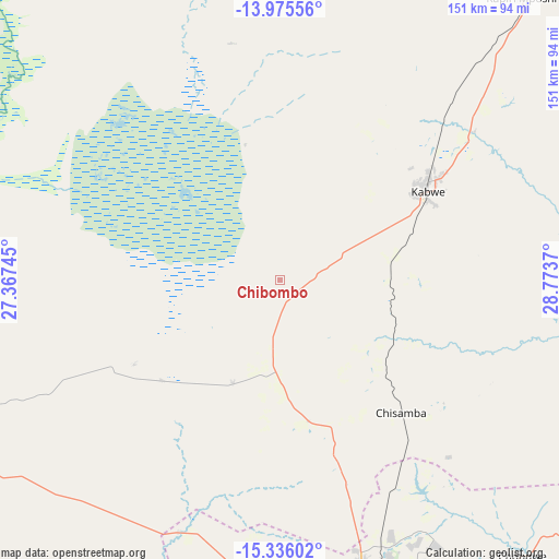
Chibombo GPS coordinates[2]
14° 39' 24.66" South, 28° 4' 14.052" East
| Map corner | latitude | longitude |
|---|---|---|
| Upper-left | -13.97556°, | 27.36745° |
| Center: | -14.65685°, | 28.07057° |
| Lower-right: | -15.33602°, | 28.7737° |
| Map W x H: | 151.3×151.3 km | = 94×94mi |
| max Lat: | -8.46887° ⇑68.2% North |
| Chibombo: | -14.65685° |
| min Lat: | ⇓31.8% South -17.84194° |
| min Long | Chibombo | max Long |
| 22.67926° | 28.07057° | 33.1782° |
| W 42.4%⇐ | ⇒57.6% E |
Elevation
Elevation of Chibombo is 1156 m = 3793 ft, and this is 12.6 m = 41 ft above average elevation for this country.
| Max E: |
1622 m = 5322 ft | 53% |
| Chibombo | 1156 m 3793 ft | |
| Avg. | 1143.4 m = 3751 ft | |
Min E: |
328 m = 1076 ft | 47% |
See also: Zambia elevation on elevation.city.
Geographical zone
Chibombo is located in South Torrid zone (between Equator and Tropic of Capricorn). Distance of this Southern Tropic circle is 976.2 km =606.6 mi to South.| Distance of | km | miles | from Chibombo |
|---|---|---|---|
| Equator | 1629.7 | 1012.6 | to North |
| Tropic Capricorn | 976.2 | 606.6 | to South |
| Antarctic Circle | 5771.5 | 3586.2 | to South |
| South Pole | 8377.4 | 5205.5 | to South |


Nearby cities:
15 places around Chibombo: (largest is in red/bold)
• Chongwe
99.5 km =61.8 mi,  138°
138°
• Kabwe
46.7 km =29 mi,  60°
60°
• Kafue
124.2 km =77.2 mi,  174°
174°
• Kalulushi
201.9 km =125.5 mi,  0°
0°
• Kapiri Mposhi
99.9 km =62.1 mi,  40°
40°
• Kitwe
206.8 km =128.5 mi, 4°
• Luanshya
173.1 km =107.6 mi,  12°
12°
• Lusaka
86.6 km =53.8 mi,  164°
164°
• Mazabuka
137.8 km =85.6 mi,  194°
194°
• Mkushi
183.4 km =114 mi,  51°
51°
• Monze
191.5 km =119 mi,  199°
199°
• Mpongwe
127.9 km =79.5 mi, 4°
• Mumbwa
114.3 km =71 mi,  251°
251°
• Nakambala
134.4 km =83.5 mi, 193°
• Ndola
198.5 km =123.3 mi,  17°
17°
Sources, notices
• [Note1] Compared only with cities in Zambia existing in our database
• [Src1] Map data: © OpenStreetMap contributors (CC-BY-SA)
• [Src2] Other city data from geonames.org with taken over terms of usage.
• [Src3] Geographical zone / Annual Mean Temperature by Robert A. Rohde @ Wikipedia
