Mazabuka geodata
Mazabuka (Southern) is a populated place; located in Zambia in Africa/Lusaka (GMT+2) time zone. With population of 64,006 people, there are 11 cities with bigger population in this country. Compared to other cities in Zambia, 86.4% of cities are located further ↑North; 65.2% of cities are located further →East and 68.2% of cities have higher elevation than Mazabuka. Note1


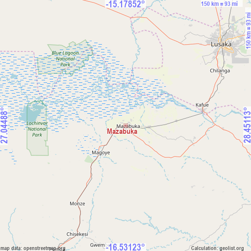
Mazabuka GPS coordinates[2]
15° 51' 21.636" South, 27° 44' 52.8" East
| Map corner | latitude | longitude |
|---|---|---|
| Upper-left | -15.17852°, | 27.04488° |
| Center: | -15.85601°, | 27.748° |
| Lower-right: | -16.53123°, | 28.45113° |
| Map W x H: | 150.4×150.4 km | = 93.5×93.5mi |
| max Lat: | -8.46887° ⇑86.4% North |
| Mazabuka: | -15.85601° |
| min Lat: | ⇓13.6% South -17.84194° |
| min Long | Mazabuka | max Long |
| 22.67926° | 27.748° | 33.1782° |
| W 34.8%⇐ | ⇒65.2% E |
Elevation
Elevation of Mazabuka is 1050 m = 3445 ft, and this is 93.4 m = 306 ft below average elevation for this country.
| Max E: |
1622 m = 5322 ft | 68.2% |
| Avg. | 1143.4 m = 3751 ft | |
| Mazabuka | 1050 m = 3445 ft | |
Min E: |
328 m = 1076 ft | 31.8% |
See also: Mazabuka elevation on elevation.city.
Geographical zone
Mazabuka is located in South Torrid zone (between Equator and Tropic of Capricorn). Distance of this Southern Tropic circle is 842.9 km =523.8 mi to South.| Distance of | km | miles | from Mazabuka |
|---|---|---|---|
| Equator | 1763 | 1095.5 | to North |
| Tropic Capricorn | 842.9 | 523.8 | to South |
| Antarctic Circle | 5638.2 | 3503.4 | to South |
| South Pole | 8244 | 5122.6 | to South |


Nearby cities:
15 places around Mazabuka: (largest is in red/bold)
• Chibombo
137.8 km =85.6 mi,  14°
14°
• Choma
133.5 km =83 mi,  217°
217°
• Chongwe
115.9 km =72 mi,  59°
59°
• Gwembe
72.9 km =45.3 mi,  191°
191°
• Kabwe
173.7 km =107.9 mi,  25°
25°
• Kafue
47.4 km =29.5 mi,  78°
78°
• Kapiri Mposhi
231.8 km =144 mi, 25°
• Lusaka
76.3 km =47.4 mi,  49°
49°
• Maamba
179.6 km =111.6 mi,  200°
200°
• Monze
55.3 km =34.4 mi,  210°
210°
• Mumbwa
121.8 km =75.7 mi,  322°
322°
• Nakambala
4.3 km =2.7 mi, 52°
• Namwala
140.6 km =87.4 mi,  274°
274°
• Siavonga
127.6 km =79.3 mi,  126°
126°
• Sinazongwe
159.2 km =98.9 mi, 191°
Sources, notices
• [Note1] Compared only with cities in Zambia existing in our database
• [Src1] Map data: © OpenStreetMap contributors (CC-BY-SA)
• [Src2] Other city data from geonames.org with taken over terms of usage.
• [Src3] Geographical zone / Annual Mean Temperature by Robert A. Rohde @ Wikipedia
