Monze geodata
Monze (Southern) is a populated place; located in Zambia in Africa/Lusaka (GMT+2) time zone. With population of 30,257 people, there are 19 cities with bigger population in this country. Compared to other cities in Zambia, 89.4% of cities are located further ↑North; 68.2% of cities are located further →East and 60.6% of cities have higher elevation than Monze. Note1


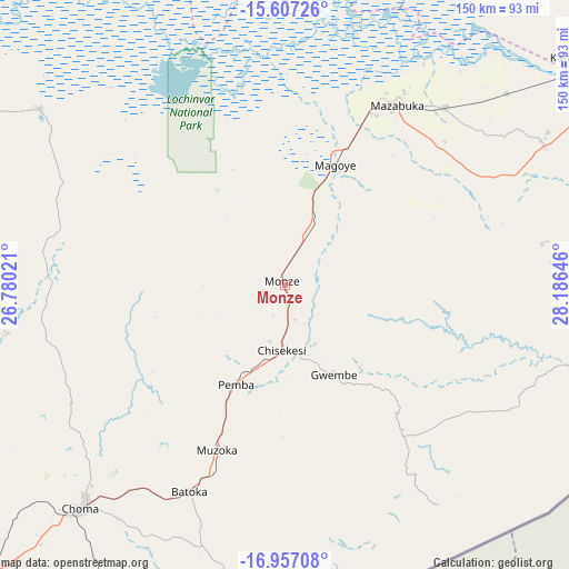
Monze GPS coordinates[2]
16° 16' 59.988" South, 27° 28' 59.988" East
| Map corner | latitude | longitude |
|---|---|---|
| Upper-left | -15.60726°, | 26.78021° |
| Center: | -16.28333°, | 27.48333° |
| Lower-right: | -16.95708°, | 28.18646° |
| Map W x H: | 150.1×150.1 km | = 93.3×93.3mi |
| max Lat: | -8.46887° ⇑89.4% North |
| Monze: | -16.28333° |
| min Lat: | ⇓10.6% South -17.84194° |
| min Long | Monze | max Long |
| 22.67926° | 27.48333° | 33.1782° |
| W 31.8%⇐ | ⇒68.2% E |
Elevation
Elevation of Monze is 1124 m = 3688 ft, and this is 19.4 m = 64 ft below average elevation for this country.
| Max E: |
1622 m = 5322 ft | 60.6% |
| Avg. | 1143.4 m = 3751 ft | |
| Monze | 1124 m = 3688 ft | |
Min E: |
328 m = 1076 ft | 39.4% |
See also: Zambia elevation on elevation.city.
Geographical zone
Monze is located in South Torrid zone (between Equator and Tropic of Capricorn). Distance of this Southern Tropic circle is 795.4 km =494.2 mi to South.| Distance of | km | miles | from Monze |
|---|---|---|---|
| Equator | 1810.5 | 1125 | to North |
| Tropic Capricorn | 795.4 | 494.2 | to South |
| Antarctic Circle | 5590.6 | 3473.8 | to South |
| South Pole | 8196.5 | 5093.1 | to South |


Nearby cities:
15 places around Monze: (largest is in red/bold)
• Chibombo
191.5 km =119 mi,  19°
19°
• Choma
78.8 km =49 mi,  222°
222°
• Chongwe
166.4 km =103.4 mi,  50°
50°
• Gwembe
27.2 km =16.9 mi,  151°
151°
• Kabwe
228.8 km =142.2 mi,  26°
26°
• Kafue
94 km =58.4 mi, 52°
• Livingstone
245 km =152.2 mi, 224°
• Lusaka
130 km =80.8 mi,  41°
41°
• Maamba
125.6 km =78 mi,  196°
196°
• Mazabuka
55.3 km =34.4 mi, 30°
• Mumbwa
151.5 km =94.1 mi,  342°
342°
• Nakambala
59.3 km =36.8 mi, 32°
• Namwala
126.4 km =78.5 mi,  297°
297°
• Siavonga
133.7 km =83.1 mi,  102°
102°
• Sinazongwe
108.8 km =67.6 mi,  181°
181°
Sources, notices
• [Note1] Compared only with cities in Zambia existing in our database
• [Src1] Map data: © OpenStreetMap contributors (CC-BY-SA)
• [Src2] Other city data from geonames.org with taken over terms of usage.
• [Src3] Geographical zone / Annual Mean Temperature by Robert A. Rohde @ Wikipedia
