Siavonga geodata
Siavonga (Southern) is a populated place; located in Zambia in Africa/Lusaka (GMT+2) time zone. With population of 18,638 people, there are 28 cities with bigger population in this country. Compared to other cities in Zambia, 92.4% of cities are located further ↑North; 62.1% of cities are located further ←West and 97% of cities have higher elevation than Siavonga. Note1


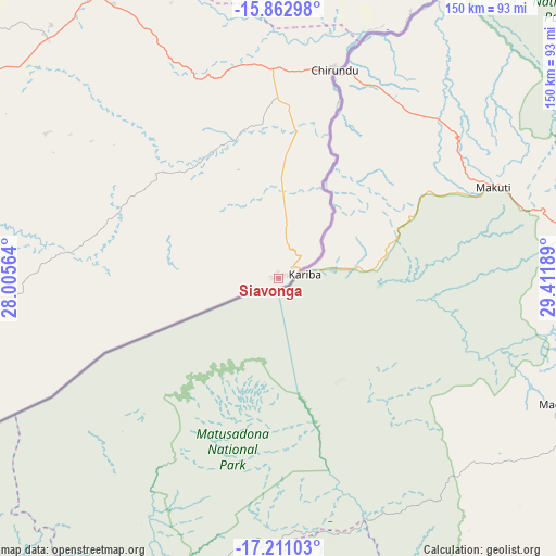
Siavonga GPS coordinates[2]
16° 32' 17.448" South, 28° 42' 31.536" East
| Map corner | latitude | longitude |
|---|---|---|
| Upper-left | -15.86298°, | 28.00564° |
| Center: | -16.53818°, | 28.70876° |
| Lower-right: | -17.21103°, | 29.41189° |
| Map W x H: | 149.9×149.9 km | = 93.1×93.1mi |
| max Lat: | -8.46887° ⇑92.4% North |
| Siavonga: | -16.53818° |
| min Lat: | ⇓7.6% South -17.84194° |
| min Long | Siavonga | max Long |
| 22.67926° | 28.70876° | 33.1782° |
| W 62.1%⇐ | ⇒37.9% E |
Elevation
Elevation of Siavonga is 528 m = 1732 ft, and this is 615.4 m = 2019 ft below average elevation for this country.
| Max E: |
1622 m = 5322 ft | 97% |
| Avg. | 1143.4 m = 3751 ft | |
| Siavonga | 528 m = 1732 ft | |
Min E: |
328 m = 1076 ft | 3% |
See also: Zambia elevation on elevation.city.
Geographical zone
Siavonga is located in South Torrid zone (between Equator and Tropic of Capricorn). Distance of this Southern Tropic circle is 767 km =476.6 mi to South.| Distance of | km | miles | from Siavonga |
|---|---|---|---|
| Equator | 1838.9 | 1142.6 | to North |
| Tropic Capricorn | 767 | 476.6 | to South |
| Antarctic Circle | 5562.3 | 3456.3 | to South |
| South Pole | 8168.2 | 5075.5 | to South |


Nearby cities:
15 places around Siavonga: (largest is in red/bold)
• Chibombo
220.1 km =136.8 mi,  341°
341°
• Choma
185.8 km =115.5 mi,  260°
260°
• Chongwe
134.5 km =83.6 mi,  358°
358°
• Gwembe
117.5 km =73 mi,  272°
272°
• Kabwe
234.2 km =145.5 mi,  353°
353°
• Kafue
102.4 km =63.6 mi,  326°
326°
• Luangwa
209.3 km =130.1 mi,  60°
60°
• Lusaka
133.6 km =83 mi, 340°
• Maamba
189.7 km =117.9 mi,  240°
240°
• Mazabuka
127.6 km =79.3 mi,  306°
306°
• Monze
133.7 km =83.1 mi,  282°
282°
• Mumbwa
246.9 km =153.4 mi, 314°
• Nakambala
126.5 km =78.6 mi, 308°
• Namwala
257.8 km =160.2 mi,  289°
289°
• Sinazongwe
155.1 km =96.4 mi, 238°
Sources, notices
• [Note1] Compared only with cities in Zambia existing in our database
• [Src1] Map data: © OpenStreetMap contributors (CC-BY-SA)
• [Src2] Other city data from geonames.org with taken over terms of usage.
• [Src3] Geographical zone / Annual Mean Temperature by Robert A. Rohde @ Wikipedia
