Mumbwa geodata
Mumbwa (Central) is a populated place; located in Zambia in Africa/Lusaka (GMT+2) time zone. With population of 19,086 people, there are 27 cities with bigger population in this country. Compared to other cities in Zambia, 71.2% of cities are located further ↑North; 72.7% of cities are located further →East and 51.5% of cities have lower elevation than Mumbwa. Note1


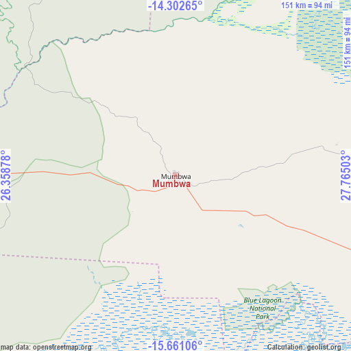
Mumbwa GPS coordinates[2]
14° 58' 58.548" South, 27° 3' 42.84" East
| Map corner | latitude | longitude |
|---|---|---|
| Upper-left | -14.30265°, | 26.35878° |
| Center: | -14.98293°, | 27.0619° |
| Lower-right: | -15.66106°, | 27.76503° |
| Map W x H: | 151×151 km | = 93.8×93.8mi |
| max Lat: | -8.46887° ⇑71.2% North |
| Mumbwa: | -14.98293° |
| min Lat: | ⇓28.8% South -17.84194° |
| min Long | Mumbwa | max Long |
| 22.67926° | 27.0619° | 33.1782° |
| W 27.3%⇐ | ⇒72.7% E |
Elevation
Elevation of Mumbwa is 1185 m = 3888 ft, and this is 41.6 m = 136 ft above average elevation for this country.
| Max E: |
1622 m = 5322 ft | 48.5% |
| Mumbwa | 1185 m 3888 ft | |
| Avg. | 1143.4 m = 3751 ft | |
Min E: |
328 m = 1076 ft | 51.5% |
See also: Zambia elevation on elevation.city.
Geographical zone
Mumbwa is located in South Torrid zone (between Equator and Tropic of Capricorn). Distance of this Southern Tropic circle is 940 km =584.1 mi to South.| Distance of | km | miles | from Mumbwa |
|---|---|---|---|
| Equator | 1665.9 | 1035.1 | to North |
| Tropic Capricorn | 940 | 584.1 | to South |
| Antarctic Circle | 5735.2 | 3563.7 | to South |
| South Pole | 8341.1 | 5182.9 | to South |


Nearby cities:
15 places around Mumbwa: (largest is in red/bold)
• Chibombo
114.3 km =71 mi,  71°
71°
• Choma
203.2 km =126.3 mi,  182°
182°
• Chongwe
178.1 km =110.7 mi,  102°
102°
• Gwembe
178.2 km =110.7 mi,  160°
160°
• Kabwe
160.4 km =99.7 mi, 68°
• Kafue
148.5 km =92.3 mi,  126°
126°
• Kaoma
244.1 km =151.7 mi,  275°
275°
• Kapiri Mposhi
206.4 km =128.3 mi,  56°
56°
• Kasempa
215.1 km =133.7 mi,  322°
322°
• Lusaka
139.7 km =86.8 mi,  109°
109°
• Mazabuka
121.8 km =75.7 mi,  142°
142°
• Monze
151.5 km =94.1 mi, 162°
• Mpongwe
201.8 km =125.4 mi,  35°
35°
• Nakambala
121.8 km =75.7 mi, 140°
• Namwala
108.4 km =67.4 mi,  218°
218°
Sources, notices
• [Note1] Compared only with cities in Zambia existing in our database
• [Src1] Map data: © OpenStreetMap contributors (CC-BY-SA)
• [Src2] Other city data from geonames.org with taken over terms of usage.
• [Src3] Geographical zone / Annual Mean Temperature by Robert A. Rohde @ Wikipedia
