Serenje geodata
Serenje (Central) is a populated place; located in Zambia in Africa/Lusaka (GMT+2) time zone. With population of 8,779 people, there are 43 cities with bigger population in this country. Compared to other cities in Zambia, 54.5% of cities are located further ↓South; 77.3% of cities are located further ←West and 92.4% of cities have lower elevation than Serenje. Note1


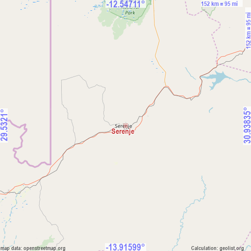
Serenje GPS coordinates[2]
13° 13' 57.036" South, 30° 14' 6.792" East
| Map corner | latitude | longitude |
|---|---|---|
| Upper-left | -12.54711°, | 29.5321° |
| Center: | -13.23251°, | 30.23522° |
| Lower-right: | -13.91599°, | 30.93835° |
| Map W x H: | 152.2×152.2 km | = 94.6×94.6mi |
| max Lat: | -8.46887° ⇑45.5% North |
| Serenje: | -13.23251° |
| min Lat: | ⇓54.5% South -17.84194° |
| min Long | Serenje | max Long |
| 22.67926° | 30.23522° | 33.1782° |
| W 77.3%⇐ | ⇒22.7% E |
Elevation
Elevation of Serenje is 1424 m = 4672 ft, and this is 280.6 m = 921 ft above average elevation for this country.
| Max E: |
1622 m = 5322 ft | 7.6% |
| Serenje | 1424 m 4672 ft | |
| Avg. | 1143.4 m = 3751 ft | |
Min E: |
328 m = 1076 ft | 92.4% |
See also: Zambia elevation on elevation.city.
Geographical zone
Serenje is located in South Torrid zone (between Equator and Tropic of Capricorn). Distance of this Southern Tropic circle is 1134.6 km =705 mi to South.| Distance of | km | miles | from Serenje |
|---|---|---|---|
| Equator | 1471.3 | 914.2 | to North |
| Tropic Capricorn | 1134.6 | 705 | to South |
| Antarctic Circle | 5929.9 | 3684.7 | to South |
| South Pole | 8535.7 | 5303.8 | to South |


Nearby cities:
15 places around Serenje: (largest is in red/bold)
• Chambishi
245.6 km =152.6 mi,  285°
285°
• Kabwe
235.6 km =146.4 mi,  235°
235°
• Kalulushi
235.9 km =146.6 mi,  280°
280°
• Kapiri Mposhi
188.1 km =116.9 mi, 244°
• Kataba
157.8 km =98.1 mi,  341°
341°
• Kitwe
224.2 km =139.3 mi, 282°
• Luanshya
197.2 km =122.5 mi,  273°
273°
• Mkushi
100.7 km =62.6 mi, 244°
• Mpika
204 km =126.8 mi,  40°
40°
• Mpongwe
227.1 km =141.1 mi,  262°
262°
• Mufulira
229.1 km =142.4 mi, 289°
• Ndola
175.8 km =109.2 mi, 279°
• Nyimba
160 km =99.4 mi,  156°
156°
• Petauke
162.2 km =100.8 mi,  133°
133°
• Samfya
220.4 km =137 mi, 340°
Sources, notices
• [Note1] Compared only with cities in Zambia existing in our database
• [Src1] Map data: © OpenStreetMap contributors (CC-BY-SA)
• [Src2] Other city data from geonames.org with taken over terms of usage.
• [Src3] Geographical zone / Annual Mean Temperature by Robert A. Rohde @ Wikipedia
