Petauke geodata
Petauke (Eastern) is a populated place; located in Zambia in Africa/Lusaka (GMT+2) time zone. With population of 19,296 people, there are 26 cities with bigger population in this country. Compared to other cities in Zambia, 62.1% of cities are located further ↑North; 84.8% of cities are located further ←West and 77.3% of cities have higher elevation than Petauke. Note1


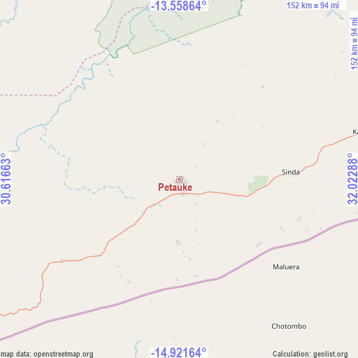
Petauke GPS coordinates[2]
14° 14' 28.212" South, 31° 19' 11.1" East
| Map corner | latitude | longitude |
|---|---|---|
| Upper-left | -13.55864°, | 30.61663° |
| Center: | -14.24117°, | 31.31975° |
| Lower-right: | -14.92164°, | 32.02288° |
| Map W x H: | 151.6×151.6 km | = 94.2×94.2mi |
| max Lat: | -8.46887° ⇑62.1% North |
| Petauke: | -14.24117° |
| min Lat: | ⇓37.9% South -17.84194° |
| min Long | Petauke | max Long |
| 22.67926° | 31.31975° | 33.1782° |
| W 84.8%⇐ | ⇒15.2% E |
Elevation
Elevation of Petauke is 1015 m = 3330 ft, and this is 128.4 m = 421 ft below average elevation for this country.
| Max E: |
1622 m = 5322 ft | 77.3% |
| Avg. | 1143.4 m = 3751 ft | |
| Petauke | 1015 m = 3330 ft | |
Min E: |
328 m = 1076 ft | 22.7% |
See also: Zambia elevation on elevation.city.
Geographical zone
Petauke is located in South Torrid zone (between Equator and Tropic of Capricorn). Distance of this Southern Tropic circle is 1022.4 km =635.3 mi to South.| Distance of | km | miles | from Petauke |
|---|---|---|---|
| Equator | 1583.5 | 983.9 | to North |
| Tropic Capricorn | 1022.4 | 635.3 | to South |
| Antarctic Circle | 5817.7 | 3615 | to South |
| South Pole | 8423.6 | 5234.2 | to South |


Nearby cities:
15 places around Petauke: (largest is in red/bold)
• Chadiza
122.2 km =75.9 mi,  80°
80°
• Chipata
158.7 km =98.6 mi,  64°
64°
• Chongwe
308.3 km =191.6 mi,  246°
246°
• Kabwe
310.4 km =192.9 mi,  265°
265°
• Kapiri Mposhi
287.3 km =178.5 mi,  275°
275°
• Kataba
310.5 km =192.9 mi,  327°
327°
• Luangwa
181.1 km =112.5 mi,  212°
212°
• Luanshya
336.8 km =209.3 mi,  291°
291°
• Lundazi
295.6 km =183.7 mi,  42°
42°
• Lusaka
350.8 km =218 mi, 248°
• Mkushi
219 km =136.1 mi, 288°
• Mpika
268 km =166.5 mi,  3°
3°
• Ndola
323.1 km =200.8 mi,  296°
296°
• Nyimba
64.7 km =40.2 mi,  237°
237°
• Serenje
162.2 km =100.8 mi,  313°
313°
Sources, notices
• [Note1] Compared only with cities in Zambia existing in our database
• [Src1] Map data: © OpenStreetMap contributors (CC-BY-SA)
• [Src2] Other city data from geonames.org with taken over terms of usage.
• [Src3] Geographical zone / Annual Mean Temperature by Robert A. Rohde @ Wikipedia
